ARKANSAS
HIKING TRAILS LIST
updated 4/30/02
If you have information or a link that you would like to see added to
this site, contact Tim
Ernst.
LONGEST HIKING TRAILS IN ARKANSAS (all
included in the Arkansas
Hiking Trails guidebook by Tim Ernst)
-
223 miles - Ouachita Trail (includes
43.6 miles in Oklahoma, mountain bikes are allowed on most of the trail
now)
-
165 miles - Ozark Highlands Trail (plus
15 miles of the Buffalo River Trail, and two other pieces that are under
construction at Norfork Lake and on the Sylamore Ranger District. This
trail will eventually be several hundred miles long and link up with the
Ozark Trail that is being built across Missouri, creating a trail system
nearly 1,000 miles long.)
-
39.5 miles - Womble Trail (mostly a
mountain bike trail, but foot traffic is allowed)
-
37.1 miles - Buffalo River Trail - South Boxley
to Pruit
-
26.8 miles - Eagle Rock Loop (this
loop combines the Little Missouri Trail, Athens-Big Fork Trail and part
of the Viles Branch Horse Trail to form the loop)
-
18.6 miles - Little Blakely Loops (there
are five loops that combine to form this total, and mountain bikes are
allowed on most of them)
-
15.7 miles - Little Missouri Trail
-
15.0 miles - Buffalo River Trail, Woolum to Tyler
Bend
-
14.5 miles - Butterfield Loop Trail
-
14.2 miles - Mt. Magazine Trail
-
13.7 miles - Sylamore Creek Trail
-
13.4 miles - Shores Lake to White Rock Loop Trail
Northwest
Arkansas region trails - Ozark Mountains
Arkansas River
Valley region trails
Southwest Arkansas
region trails - Ouachita Mountains
East Arkansas region
trails
NORTHWEST
ARKANSAS REGION Trails
Ozark Mountains
NATIONAL FOREST TRAILS
Ozark Highland Trail, Ozark
National Forest
-
Miles: 165 miles one way
-
Rating: Easy to Difficult
-
Allowed: Camping and Dogs
-
Map and Trail description available: Ozark
Highlands Trail by Tim Ernst
-
Contact: Ozark Highlands Trail Association Phone 870-861-5536
This is probably the finest hiking trail in Arkansas. It has been rated
as one of the top-10 trails in the United States. It has everything: Wonderful
vistas; terrific streamside walks; lots of deep green pools to swim in;
bluffs and rocks and boulders galore; forests that go on forever; and literally
hundreds and hundreds of waterfalls. The list goes on and on. Itís 165
miles from end to end, with 27 additional miles of connecting spurs and
loops, so it makes for a great long-distance backpacking trail. The trail
passes through 17 campgrounds and other trailheads, and crosses some 50+
forest roads and highways-all of these access points make it the perfect
dayhiking trail too-just decide how far you want to hike and youíll find
several sections between these points that fit your bill.
***EVANS POINT LOOP, Lake Fort Smith Park, is NOW CLOSED due
to a lake being built that will flood all of it***
Lake Weddington Trail, Ozark
National Forest
-
Miles: 15.4
-
Rating: Moderate-Difficult
-
Allowed: Camping and Dogs
-
Map and Trail description available: Arkansas
Hiking Trails guidebook by Tim Ernst
-
Contact: Boston Mountain Ranger District Phone
501-667-2191
This trail through the heart of the Ozarks leads past Twin Knobs, a unique
rock formation, and terminates on the banks of the Illinois River. Camping
is permitted along the trail. To return, it is necessary to retrace the
same route. This trail is often used for overnight hiking trips.
Sylamore Creek Trail, Ozark
National Forest
-
Miles: 13.7 one way
-
Rating: Moderate
-
Allowed: Camping and Dogs
-
Map and Trail description available: Arkansas
Hiking Trails guidebook by Tim Ernst
-
Contact: Sylamore Ranger District Phone 870-757-2211
This is one of the most scenic backpacking trails in the state. It follows
North Sylamore Creek the whole way-a crystal clear, spring-fed, beautiful
stretch of water-and winds around past painted limestone bluffs, and big
trees. There is something very special about this trail.
Shores Lake/White Rock Loop, Ozark
National Forest
-
Miles: 13.4
-
Rating: Moderate
-
Allowed: Camping and Dogs
-
Map and Trail description available: Arkansas
Hiking Trails and Ozark Highlands Trails guidebooks by Tim Ernst
-
Contact: Boston Mountain Ranger District
Phone 501-667-2191
Shores Lake and White Rock are two of the most popular recreation areas
in the Ozark National Forest, located northeast of Ft. Smith. This
loop trail runs from Shores Lake past several nice waterfalls, up to the
spectacular White Rock Mountain, then returns to the lake down through
the Salt Fork drainage. This is the perfect weekend hike, especially if
you are lucky enough to get a cabin at White Rock.
Redding/Spy Rock Loop, Ozark
National Forest
-
Miles: 8.8
-
Rating: Moderate
-
Allowed: Camping and Dogs
-
Map and Trail description available: Arkansas
Hiking Trails guidebook by Tim Ernst
-
Contact: Pleasant Hill Ranger District Phone
501-754-2864
This is one of four loop trails that connect with the Ozark Highlands Trail
(OHT). It passes several nice waterfalls, and has a spur that goes on out
to a wonderful view area called Spy Rock.
Pedestal Rocks/Kings Bluff Loops, Ozark
National Forest
-
Miles: 4.3 miles total
-
Rating: Easy *DANGEROUS
BLUFFS*
-
Allowed: Dogs
-
Map and Trail description available: Arkansas
Hiking Trails and Ozark Highlands Trail guidebooks by Tim Ernst
-
Contact: Bayou Ranger District Phone 501-284-3150
There are actually two loops here, and both of them visit some spectacular
and unique sandstone bluff formations, and have terrific special scenic
spots. You will be awed by Kings Bluff, and the waterfall there.
And wonít believe how the wind and water have shaped Pedestal Rocks. All
of this is located in the Pedestal Rocks Scenic Area, located near Ben
Hur, just off of Hwy. 16 in the Ozark National Forest.
Hawksbill Crag Trail, Upper Buffalo Wilderness, Ozark
National Forest
-
Miles: 3.0
-
Rating: Moderate *DANGEROUS
BLUFFS*
-
Allowed: Camping and Dogs
-
Map and Trail description available: Arkansas
Hiking Trails and Buffalo River Hiking Trails guidebooks by Tim Ernst
-
Contact: Buffalo Ranger District Phone
870-446-5122
Hawksbill Crag is one of the most recognizable spots in Arkansas. Itís
an amazing rock outcrop that sticks out from the top of a tall bluff, and
is usually photographed with hikers on it. It is located in the 14,200
acre Upper Buffalo Wilderness Area of the Ozark National Forest, near the
Buffalo River.
Horsehead Lake Trail, Horsehead Lake Recreation Area, Ozark
National Forest
-
Miles: 3.0
-
Rating: Moderate
-
Allowed: Dogs
-
Map and Trail description available: None
-
Contact: www.fs.fed.us/oonf/ozark or Phone 479-754-2864
This loop trail offers scenic views of the Ozark Mountains and Horsehead
Lake. Large hardwoods offer spectacular fall foliage.
White Rock Rim Loop, Ozark
National Forest
-
Miles: 2.1
-
Rating: Easy *DANGEROUS
BLUFFS*
-
Allowed: Dogs
-
Map and Trail description available: Arkansas
Hiking Trails and Ozark Highlands Trails guidebooks by Tim Ernst
-
Contact: Boston Mountain Ranger District Phone 501-667-2191
This is easily one of the most scenic hikes in Arkansas-ALL of it a definite
special scenic spot (SSS)!!!!!! The trail follows along the top of the
bluffline up on White Rock Mountain. Along the trail you will find a great
spot to watch the sunrise, and what is considered to be the best sunset
in the entire state. The views are spectacular all year.
Kings Bluff Loop Trail, Ozark
National Forest
-
Miles: 2.0
-
Rating: Easy-Moderate
-
Allowed: Dogs
-
Map and Trail description available: Arkansas
Hiking Trails guidebook by Tim Ernst
-
Contact: Bayou Ranger District Phone 501-284-3150
This trail travels through a forest of large hardwoods and visits the awe-inspiring
Kingís Bluff. This is a beautiful area; the bluff and the views into the
surrounding valley are simply fantastic. The creek which helped expose
this majestic sandstone bluff spills over the edge, forming one of the
highest waterfalls in this part of the Ozarks.
Glory Hole, Ozark
National Forest
-
Miles: 1.9
-
Rating: Easy going down, Moderate coming back *DANGEROUS
BLUFFS*
-
Allowed: Camping and Dogs
-
Map and Trail description available: Arkansas
Hiking Trails guidebook by Tim Ernst
-
Contact: Buffalo Ranger District Phone 870-446-5122
This is another neat little spot that many have visited, but most couldnít
find until now. The trail is an old road that drops down the hill to this
most unique spot. A creek has actually drilled a large hole through the
roof of a big overhanging bluff, and the creek pours right down through
the roof. Itís a pretty remarkable thing to see when the water is running
well!!
Alum Cove Trail, Ozark
National Forest
-
Miles: 1.1
-
Rating: Easy, a little steep on way out
-
Allowed: Dogs
-
Map and Trail description available: Arkansas
Hiking Trails and Buffalo River Hiking Trails guidebooks by Tim Ernst
-
Contact: Buffalo Ranger District Phone 870-446-5122
This wonderful little trail visits one of the largest natural rock bridges
in this part of the country. It loops around past a nice bluffline too.
There is some tall timber, and lots of flowers, including a rare variety
of Shooting Star. This trail is located in the Ozark National Forest. There
is a picnic area here, but no camping is allowed.
Koen Interpretive Trail, Ozark
National Forest
-
Miles: one-half mile (.5)
-
Rating: Easy, Great first hike for very young children
-
Allowed: Dogs
-
Map and Trail description available: Arkansas
Hiking Trails and Buffalo River Hiking Trails guidebooks by Tim Ernst
-
Contact: Buffalo Ranger District Phone 870-446-5122
If you are looking for a nice leisurely stroll through a variety of tree
species, this is the trail for you. There are at least 34 different kinds
of trees and other plants identified along this short loop.
NATIONAL PARKS TRAILS
Buffalo River Trail, Buffalo
National River
-
Miles: 37.0 one way
-
Rating: Easy to Difficult
-
Allowed: Camping, no dogs
-
Map and Trail description available: Arkansas
Hiking Trails and Buffalo River Hiking Trails guidebooks by Tim Ernst
-
Contact: Buffalo National River Phone 870-741-5443
This is the beginning of the Buffalo River Trail, one of the longest in
Arkansas. The first stretch winds around the hills on the east side of
the Buffalo River, giving views of the river and historic Boxley Valley
seldom seen. It ends at the low water bridge at Ponca, where the rest of
the trail continues on to Pruitt, at total length of 36.5 miles. The trail
is not blazed.
Old River Trail, Buffalo
National River
-
Miles: 24
-
Rating: Easy-Moderate
-
Allowed: Horses and Camping, No Dogs
-
Map and Trail description available: Buffalo
River Hiking Trails by Tim Ernst
-
Contact: Buffalo National River Phone 870-741-5443
The Old River Trail follows a historic farm road through the bottomlands
of the Buffalo River. Along the way it visits many old farmsteads and other
historical features.
Buffalo River Trail (Woolum to Hwy. 65), Buffalo
National River
-
Miles: 15.0 one way
-
Rating: Moderate
-
Allowed: Camping, no dogs
-
Map and Trail description available: Arkansas
Hiking Trails, Buffalo River Hiking Trails, and Ozark Highlands Trail guidebooks
by Tim Ernst
-
Contact: Buffalo National River Phone 870-741-5433
This is another sleeper trail-it has some tremendous scenery, but because
access to the upper end of the trail is limited, it wonít get a great deal
of use. It begins in the Richland Creek Valley, just across the Buffalo
River from Woolum, runs across the tops of many bluffs that overlook the
river, goes through Tyler Bend Park, and comes out onto the Hwy. 65 bridge
over the Buffalo.
Cow Creek-Cook Hollow Loop, Buffalo
National River
-
Miles: 10.5
-
Rating: Moderate
-
Allowed: no dogs
-
Map and Trail description available: Buffalo
River Hiking Trails guidebook by Tim Ernst
-
Contact: Buffalo National River Phone 870-741-5443
This trail is used by horses quite a bit so it is recommended that it be
hiked in the winter, views are better at this time anyway. Items for early
Ozark inhabitants may be found along the way. Please leave these artifacts
so that others may enjoy them.
Pea Ridge Trail, Pea
Ridge National Military Park
-
Miles: 8.7
-
Rating: Moderate
-
Allowed: no dogs
-
Map and Trail description available: Arkansas
Hiking Trails guidebook by Tim Ernst
-
Contact: Pea Ridge National Military Park Phone
501-451-8122
This loop trail is historical sure, but also interesting and scenic. It
is pretty easy to hike, as it follows many old roads through open fields.
There are lots of deer around.
Cecil Cove Loop Trail, Buffalo
National River
-
Miles: 7.4
-
Rating: Moderate
-
Allowed: Camping and Horses, no dogs
-
Map and Trail description available: Arkansas
Hiking Trails and Buffalo River Hiking Trails guidebooks by Tim Ernst
-
Contact: Buffalo National River Ph. (870)741-5443
This scenic trail runs along Cecil Creek (crossing is several times), then
loops back up high on a bench and drops down to the Buffalo River and Goat
Bluff- there are lots of special scenic spots along the way. It visits
many historical sites too.
Hemmed-In Hollow, Buffalo
National River
-
Miles: 5.0
-
Rated: Difficult
-
Allowed: Camping allowed on part of trail, no dogs
-
Map and Trail description available: Arkansas
Hiking Trails and Buffalo River Hiking Trails guidebooks by Tim Ernst
-
Contact: Buffalo National River Phone 870-741-5443
This is one of two trailheads that will take you down into the famed Hemmed-In
Hollow at Buffalo National River, and to the tallest waterfall between
the Rockies and the Appalachians. Itís the Compton Trailhead. This is a
steep trail, both going in and especially coming out, but if you can handle
it, you will be rewarded greatly!!
Tyler Bend Trails System, Buffalo
National River
-
Miles: nine-tenths (.9) to 4.0 miles
-
Rating: Easy
-
Allowed: No dogs
-
Map and Trail description available: Arkansas
Hiking Trails and Buffalo River Hiking Trails guidebooks by Tim Ernst
-
Contact: Buffalo National River Phone 870-741-5443
Tyler Bend is one of the main visitor facilities on the Buffalo River.
There is a nice Visitor Center and museum there, as well as campgrounds,
picnic areas, and canoe access. Tyler Bend is located off of Hwy 65 between
St. Joe and Marshall, just south of the Hwy 65 bridge across the Buffalo.
There are three trail parking areas-one off to the left as you begin the
drive down the hill to the Visitor Center, the Visitor Center itself, and
just beyond the Visitor Center on the right, at the Amphitheater. There
are four trails in the park, and all of them connect with the Buffalo River
Trail, and to each other. You can make several different lengths of loop
hikes by connecting these trails.
Rush Mountain Trail, Buffalo
National River
-
Miles: 3.6
-
Rating: Easy to Moderate
-
Allowed: No dogs
-
Map and Trail description available: Arkansas
Hiking Trails and Buffalo River Hiking Trails guidebooks by Tim Ernst
-
Contact: Buffalo National River Phone 870-741-5443
Rush is an old mining town, a ghost town if you will, that was first opened
up in the 1880ís when zinc ore was discovered. The community that was built
up around the mines endured until the 1960ís. Some of the buildings still
exist today, and two different trails visit the area. The Rush Mountain
Trail, is a longer trail that goes past many of the old mines, loops around
and goes up and over Rush Mountain. All of this area is now part of Buffalo
National River. A word of caution: Do not enter any of the
mines. Many of them are very unstable.
Gilbert Railroad Trail, Buffalo
National River
-
Miles: 3.4 round trip
-
Rating: Easy
-
Allowed: no dogs
-
Map and Trail description available: Buffalo
River Hiking Trails guidebook by Tim Ernst
-
Contact: Buffalo National River Phone 870-741-5443
Gilbert is a sleepy old town right down on the Buffalo River. If you pay
much attention to the weather reports in the winter, you probably know
that this is one of the coldest spots in the state! The trail travels on
an old railroad grade and is level the entire way. The trail runs above
the river for 1.5 miles.
Indian Rockhouse Loop, Buffalo
National River
-
Miles: 3.0 round trip
-
Rating: Easy but steep climb out
-
Allowed: No dogs
-
Map and Trail description available: Arkansas
Hiking Trails and Buffalo River Hiking Trails guidebooks by Tim Ernst
-
Contact: Buffalo National River Phone 870-741-5443
Buffalo Point is the most developed public area within Buffalo National
River. Besides a Visitor Center, there are several campgrounds, cabins,
a restaurant, picnic areas, river access, and a number of hiking trails.
Most of these trails just connect facilities, but one, the Indian Rockhouse
Trail, is a wonderful three-mile loop into a scenic area, and visits one
of the largest bluff overhangs in the Ozarks.
Lost Valley Trail, Buffalo
National River
-
Miles: 2.3 round trip
-
Rating: Easy
-
Allowed: No dogs
-
Map and Trail description available: Arkansas
Hiking Trails and Buffalo River Hiking Trails guidebooks by Tim Ernst
-
Contact: Buffalo National River Phone 870-741-5443
This little area is one of the special places in the world. Calling it
an SSS (special scenic spot) is an understatement! This popular trail is
short, and for the most part, very easy to hike. Although the last section
of trail does get pretty steep as it climbs up to a cave so be sure to
bring a flashlight (one for each) if you wish to go into the cave.
Mill Creek Loop, Buffalo
National River
-
Miles: 2.2 round trip
-
Rating: Easy
-
Allowed: No dogs.
-
Map and Trail description available: Arkansas
Hiking Trails and Buffalo River Hiking Trails guidebooks by Tim Ernst
-
Contact: Buffalo National River Phone 870-741-5443
If you are traveling down National Scenic 7 Byway between Harrison and
Jasper, you should stop at Pruitt and hike this short trail. It is located
at Buffalo National River, just off of Hwy. 7 at the lower end of the Pruitt
river access. It is easy to walk, and goes through a variety of forest
and stream environments, not to mention a couple of historical spots.
Old Erbie Area Loop, Buffalo
National River
-
Miles: 1.8
-
Rating: Easy
-
Allowed: No dogs
-
Map and Trail description available: Buffalo
River Hiking Trails guidebook by Tim Ernst
-
Contact: Buffalo National River Phone 870-741-5443
This little loop is an easy and scenic stroll. It is about half road walking
and half trail. It begins at the Cecil Cove Trailhead. There is a
lot of history to this area with a chance to see a lot of elk, large bluffs,
Spanish moss, twisted cedar trees and many other wonderful sites.
Hideout Hollow Trail, Buffalo
National River
-
Miles: 1.7 round trip
-
Rating: Easy *DANGEROUS
BLUFFS*
-
Allowed: Camping, No dogs
-
Map and Trail description available: Arkansas
Hiking Trails and Buffalo River Hiking Trails guidebooks by Tim Ernst
-
Contact: Buffalo National River Phone 870-741-5443
This is a wonderful little trail that takes you into a large bluff and
waterfall area. It is often overlooked by hikers, since it is one of the
lesser-known trails in the Buffalo National River trails system-you wonít
see many other folks here. The hike is pretty easy, with only a few ups
and downs. There are lots of bluffs in this area and a waterfall as well.
Headwaters Creek Trail, Pea
Ridge National Military Park
-
Miles: four-tenths of a mile (.4)
-
Rating: Easy
-
Allowed:
-
Map and Trail description available: Visitor Center
-
Contact: www.nps.gov/peri or Phone 479-451-8122
This self-guided interpretive trail begins and ends at the Elk Horn Tavern,
made famous during the Civil War. Both the natural and historical features
of the park are discussed in the available booklet.
Ponds Trail, Buffalo
National River
-
Miles: four-tenths of a mile (.4)
-
Rating: Easy
-
Allowed: no dogs
-
Map and Trail description available: Buffalo
River Hiking Trails guidebook by Tim Ernst
-
Contact: Buffalo National River Phone 870-741-5443
There is a small picnic area that is located on the road from Hwy 7 (2
miles on gravel) to Erbie that is called Cedar Grove Picnic Area. There
is a nice overlook of the Buffalo River there. Also the Buffalo River Trail
comes right through it. And there are a couple of short trails that lead
off to two ponds-South Pond and North Pond. These are very short trails,
and one of them is wheelchair accessible.
U.S. ARMY CORPS OF ENGINEERS TRAILS
Lake Norfork Trail, Corps
of Engineers
-
Miles: 5.2 one way
-
Rating: Easy
-
Allowed: Dogs
-
Map and Trail description available: Arkansas
Hiking Trails guidebook by Tim Ernst
-
Contact: Bull Shoals/Norfork Lake Phone
870-425-2700
The Lake Norfork Trail will eventually be 84 miles long. This 5.2-mile
stretch, which begins at the dam and runs along the lake shore, was built
in 1993. Another 4 miles will be built in 1994. Since things will be changing
so rapidly, be sure to check with the Corps of Engineers office in Mountain
Home for the latest information.
Lost Bridge Loop, Corps
of Engineers
-
Miles: 5.0
-
Rating: Easy to Moderate
-
Allowed: Camping and Dogs
-
Map and Trail description available: Arkansas
Hiking Trails guidebook by Tim Ernst
-
Contact: Beaver Lake Phone 479-636-1210
This loop trail is one of the shorter backpacking trails in the state,
and it has some great views of Beaver Lake, several bluffs, and visits
a historical homestead site. It is located in Lost Bridge Park.
Robinson Point Trail, Corps
of Engineers
-
Miles: 3.3 round trip
-
Rating: Easy
-
Allowed: Dogs
-
Map and Trail description available: Arkansas
Hiking Trails guidebook by Tim Ernst
-
Contact: Bull Shoals/Norfork Lake Phone 870-425-2700
This National Recreation Trail, just outside of Mountain Home, winds around
the shores of Lake Norfork, and has a spectacular view of the lake from
high atop a terrific bluff area. It also visits some stands of very old,
twisted cedar trees that have a great deal of character. And in the springtime,
there are lots and lots of wildflowers scattered all along the trail.
Dogwood Nature Trail, Corps
of Engineers
-
Miles: 3.0 round trip
-
Rating: Easy
-
Allowed: Dogs
-
Map and Trail description available: Arkansas
Hiking Trails guidebook by Tim Ernst
-
Contact: Bull Shoals/Norfork Lake Phone 870-425-2700
This trail winds through the woods just above Bull Shoals Lake, and ends
at a spectacular set of bluffs that disappear deep into the waters. It
is located at Lakeview Park, just outside the community of Lakeview, near
Bull Shoals Dam. There is a brochure about the trail available at the entrance
station.
Sugar Loaf Mountain Loop, Corps
of Engineers
-
Miles: 2.0
-
Rating: Easy with a lot of steps
-
Allowed: Dogs
-
Map and Trail description available: Arkansas
Hiking Trails guidebook by Tim Ernst
-
Contact: Greers Ferry Lake Phone 501-362-2416
****NOTE- We have had reports that the trail at
Sugar Loaf Mountain is in need of great repair. We will keep you
posted as further information is available.****
This is one of the most unique trails in the state-itís built on an
island! Right in the middle of Greers Ferry Lake. Naturally you have to
have a boat to get to it, but it is worth the extra trouble because it
just happens to also be a very spectacular trail, with lots of towering
bluffs, twisted old cedar trees, and great views. Itís a pretty good climb
to get the 560 feet to the top, but once youíre up there, itís all down
hill back to your boat.
Bench Rock Nature Trail, Corps
of Engineers
-
Miles: 1.33
-
Rating: Easy-Moderate
-
Allowed: Dogs
-
Map and Trail description available: Arkansas
Hiking Trails guidebook by Tim Ernst
-
Contact: Chief Ranger, Beaver Lake Phone 479 636-1210
This short loop trail is located on the north side of Beaver Lake, near
the community of Gateway, in the Indian Creek Recreation Area. It loop
around a nice bluffline, and has some great views across the lake.
Rim Rock Nature Loop, Corps
of Engineers
-
Miles: 1.0
-
Rating: Easy
-
Allowed: Dogs
-
Map and Trail description available: Arkansas
Hiking Trails guidebook by Tim Ernst
-
Contact: Chief Ranger, Beaver Lake Phone 479-636-1210
This short trail takes an intimate look at a long bluffline that is tucked
away in the Prairie Creek Park at Beaver Lake.
Natural Sidewalk Nature Trail, Beaver Lake Area, Corps
of Engineers
-
Miles: one-half of a mile (.5)
-
Rating: Easy
-
Allowed: Dogs
-
Map and Trail description available: Visitor Center
-
Contact: Chief Ranger, Beaver Lake Phone 479-636-1210
About half the length of this 2,400 foot trail lies along a shelf cut by
nature in a limestone bluff rising from the waters of the lake. The trail
leads you along the shoreline under the overhanging bluffs. Here you will
find scenic beauty and interesting geologic formations. A number of the
gnarled cedars are several hundred years old. There is a beautiful scenic
overlook on top of the bluff.
Mossy Bluff/Buckeye Trail, Greers Ferry Lake Area, Corps
of Engineers
-
Miles: one-half of a mile (.5)
-
Rating: Easy **a portion of the
trail is wheelchair accessible**
-
Allowed: Dogs
-
Map and Trail description available: Corp of Engineers Visitor Center
-
Contact: Operations Manager Phone 501-362-2416
Downstream from the dam, this trail meanders along a bluff overlooking
the Little Red River and fish hatchery. The trail is mostly level, except
at each end, where mossy bluffs are crossed by flights of stairs. The trail
provides excellent views from an overlook shelter of the Greers Ferry dam
and lake, in addition to the river valley. The Buckeye Trail was constructed
in conjunction with the Mossy Bluff Trail to provide a quality trail experience
for persons who are not physically able to negotiate the more difficult
areas. Displays are provided alongside these trails for interpretation
of interesting natural features.
Fishtrap Trail, Beaver Lake Area, Corps
of Engineers
-
Miles: one-third of a mile (.33)
-
Rating: Moderate to Difficult
-
Allowed: Dogs
-
Map and Trail description available: Visitor Center
-
Contact: Chief Ranger, Beaver Lake Phone 479-636-1210
This trail extends a short distance uphill to a level bench on the hillside
leading to a long overhanging bluff. The bluff is typical of the many such
shelters of prehistoric bluff-dwelling Indian tribes.
ARKANSAS STATE PARKS TRAILS
Butterfield Loop Trail, Devilís
Den State Park
-
Miles: 14.5
-
Rating: Moderate
-
Allowed: Camping and Dogs. Bicycles and Horses are allowed on part of trail
-
Map and Trail description available: Arkansas
Hiking Trails guidebook by Tim Ernst
-
Contact: Devilís Den State Park Phone 501-761-3325
This is the longest of several trails at Devilís Den State Park. Camping
is permitted at the 3 primitive campsites along the way. Part of this loop
follows picturesque Blackburn Creek, and part of it overlooks the Lee Creek
Valley. There are numerous geological formations to explore, including
the wonderful Quail Valley area.
Pigeon Roost Trail, Beaver
Lake State Park
-
Miles: 4.2 and 8.4 loops
-
Rating: Easy Backpack, Moderate Dayhike
-
Allowed: Camping and Dogs
-
Map and Trail description available: Arkansas
Hiking Trails guidebook by Tim Ernst
-
Contact: Beaver Lake State Park Phone 501-789-2380
There are actually two loops on this trail, and they make up a figure eight
sort of pattern. Overnight camping is allowed on the longer loop-there
are 5 small primitive sites available.
Woolly Hollow Loop, Woolly
Hollow State Park
-
Miles: 3.5
-
Rating: Easy
-
Allowed: Dogs
-
Map and Trail description available: Arkansas
Hiking Trails guidebook by Tim Ernst
-
Contact: Woolly Hollow State Park Phone 501-679-2098
This is a fairly easy-to-hike trail that loops around Lake Bennett at this
State Park. It visits a number of hillside glades. There are some nice
campsites in the park, as well as a Visitor Center, covered pavilion, swimming
beach, and showers.
Huckleberry Trail, Woolly
Hollow State Park
-
Miles: 3 1/2 miles
-
Rating: Easy-Moderate
-
Allowed: Dogs
-
Map and Trail description available: None
-
Contact: [email protected] or Phone (501)679-2098
Beginning at the bathhouse in the campground and looping around Lake Bennett,
the trail climbs the ridge, offering scenic views of the lake. Crossing
the lakeís earthen dam, the trail winds through a hardwood forest back
to the main area of the park.
Yellow Rock Trail, Devilís
Den State Park
-
Miles: 3.0
-
Rating: Moderate
-
Allowed: Dogs
-
Map and Trail description available: Visitors Center
-
Contact: [email protected] or Phone (479)761-3325
Forest scenery and a spectacular view from Yellow Rock Bluff await hikers
on this trail.
War Eagle Trail, Withrow
Springs State Park
-
Miles: 2.0 round trip
-
Rating: Easy
-
Allowed: Dogs
-
Map and Trail description available: Arkansas
Hiking Trails guidebook by Tim Ernst
-
Contact: Withrow Springs State Park Phone 501- 559-2593
This short, easy trail runs alongside beautiful War Eagle River, and visits
a cave (bring your flashlight) and towering bluffs in the Withrow Springs
State Park.
Bluebird Trail, Bull
Shoals State Park
-
Miles: 2.0
-
Rating: Easy
-
Allowed: Dogs
-
Map and Trail description available: Visitor Center
-
Contact: [email protected] or Phone 870-431-5521
Not a traditional trail, this collection of bluebird houses through the
campground is a flurry of activity each spring and summer as the eastern
bluebirds use these homes to raise their young. Walking the grassy lawn
area from house to house and enjoying the nesting and feeding behaviors
of these bluebirds is very rewarding.
Big Bluff Trail, Bull
Shoals-White River State Park
-
Miles: 1.75
-
Rating: Easy
-
Allowed: dogs
-
Map and Trail description available: Visitor Center
-
Contact: [email protected] or Phone 870-431-5521
The trail traverses the wooded hills below Bull Shoals Dam. Overlooking
the White River, the trail offers examples of plant succession and wildlife
native to the area. A portion of the trail is located near a bluff, so
be careful to stay on the trail at all times.
Devilís Den Self-Guided Trail, Devilís
Den State Park
-
Miles: 1.5
-
Rating: Moderate
-
Allowed: Dogs
-
Map and Trail description available: Visitor Center
-
Contact: [email protected] or Phone 479-761-3325
The Devilís Den Trail, one of the most popular trails within the park,
features two fracture caves: the Devils Den and the Devilís Icebox. Gravity
flow springs, peculiar erosional remnants of sandstone strata, wet weather
waterfalls, and lush Ozark plant and animal life are just a few of the
sights you can expect as you wind through the rugged Boston Mountain terrain.
A flashlight is necessary to explore the caves. Extreme caution should
be used while walking in the cave area due to open crevasses! Trailheads
are located behind the visitor center and by the Highway 170 bridge at
Lee Creek. Parking is available at both locations.
Shaddox Hollow Loop, Beaver
Lake State Park
-
Miles: 1.5
-
Rating: Easy
-
Allowed: Dogs
-
Map and Trail description available: Arkansas
Hiking Trails guidebook by Tim Ernst
-
Contact: Beaver Lake State Park Phone
501-789-2380
This is a short, popular loop that visits Shaddox Hollow Natural
Area and is located along the shores of Beaver Lake in NW Arkansas near
Rocky Branch. Besides lots of bluffs and streamsides, this area contains
a wide variety of fauna and flora, and is frequented by school science
classes and used as a training aid.
Battlefield Trail, Prairie
Grove Battlefield State Park
-
Miles: 1.0
-
Rating: Easy-Moderate
-
Allowed: Dogs
-
Map and Trail description available: Visitor Center
-
Contact: [email protected] or Phone 479 846-2990
Located on the eastern side of the Prairie Grove Battlefield where two
Union charges and two Confederate counterattacks occurred. There are twelve
wayside exhibit panels with the quotes from participants and witnesses
to the battle with daily guided tours along part of the trail.
Lake Trail, Devilís
Den State Park
-
Miles: 1.0
-
Rating: Easy
-
Allowed: Dogs
-
Map and Trail description available: Visitor Center
-
Contact: [email protected] or Phone 479-761-3325
Highlights include lake views and 100 foot suspension bridge across Lee
Creek.
Lee Creek Trail, Devilís
Den State Park
-
Miles: 1.0
-
Rating; Easy-Moderate
-
Allowed: Dogs
-
Map and Trail description available: Visitor Center
-
Contact: [email protected] or Phone 479-761-3325
Highlight is return trip through creek bed. Tennis shoes are recommended.
Lakeside Trail, Bull
Shoals-White River State Park
-
Miles: 1.0
-
Rating: Easy
-
Allowed: dogs
-
Map and Trail description available: Visitor Center
-
Contact: [email protected] or Phone 870-431-5521
This scenic trail has an abundance of wildlife and is located along a cove
on Bull Shoals Lake. It affords good viewing of spring and fall colors.
Memorial Wildflower Area, Bull
Shoals State Park
-
Miles: three-fourths of a mile (.75)
-
Rating: Easy
-
Allowed: Dogs
-
Map and Trail description available: Visitor Center
-
Contact: [email protected] or Phone 870-431-5521
This memorial wildflower garden loop trail meanders through three acres
of wildflowers that change each week through the season. Wildlife, including
birds and butterflies, can be seen throughout the trail at feeders and
rest areas. The area is under constant development and memorial contributions
may be made at any time.
CCC Interpretive Self-Guide, Devilís
Den State Park
-
Miles: one quarter of a mile (.25)
-
Rating: Easy
-
Allowed: Dogs
-
Map and Trail description available: Visitor Center
-
Contact: [email protected] or Phone 479-761-3325
Trail passes through ruins of Civilian Conservation Corps camp.
Woody Plant Trail, Devilís
Den State Park
-
Miles: one quarter of a mile (.25)
-
Rating: Easy
-
Allowed: dogs
-
Map and Trail description available: Visitor Center
-
Contact: [email protected] or Phone 479-761-3325
This short, self-guided trail begins near either bathhouse in Camping Area
E and meanders through the woods surrounding the campgrounds. To help visitors
learn more about the diversified plant life found in this part of the Ozarks,
plants along the trail have been numbered to correspond with an identification
sheet which is available at the visitor center.
Hidden Hollow Wildflower Trail, Bull
Shoals State Park
-
Miles: two hundredths of a mile (0.02)
-
Rating: Easy
-
Allowed: Dogs
-
Map and Trail description available: Visitor Center
-
Contact: [email protected] or Phone 870-431-5521
This short trail traverses a fragile woodland wildflower area. To
get to the trailhead, you must cross a wooded area with no clearly marked
trail, look for the sign approximately 50 feet into the wooded area.
OTHER AGENCY'S TRAILS
Two Turtles Trail at Lake Fayetteville, City of Fayetteville
-
Miles: 5.2
-
Rating: Easy
-
Allowed: Dogs and mountain bikes
-
Map and Trail description available: none
-
Contact: Fayetteville Parks & Recreation, 479-
This is an urban trail that goes all the way around Lake Fayetteville,
deep in the woods much of the time. It passes through a couple of picnic
areas, past the future sight of the Northwest Arkansas Botanical Gardens,
and runs along the top of the long earthen dam. One of the access points
is located at Veterans Park just across the road from the busy Northwest
Arkasnas Mall (down Zion road a block). This trail gets a lot of mountain
bike traffic, and the lake get a lot of fishing traffic - a great place
to fish or hike right in town!
Round Top Mountain Trail, Newton County Resource Council
-
Miles: 4.0
-
Rating: Easy to medium
-
Allowed: Dogs
-
Map and Trail description available: Brochure at trailhead
-
Contact: Newton County Resource Council, 870-446-5898
This is a neat trail located just south of Jasper that encircles Round
Top Mountain, passing tall bluffs with great views of the sourrounding
countryside. The trail goes to the site of a WWII bomber crash, and a lot
of the plane's parts are still visible, including one of the engines. Easy
access off of Hwy. 7.
Lake Leatherwood Trail, City of Eureka Springs
-
Miles: 3.8
-
Rating: Easy
-
Allowed: Dogs and mountain bikes, camping at park
-
Map and Trail Description: Available at park office
-
Contact: City of Eureka Springs (info posted soon)
Here is another great trail that circles a lake, and goes across the top
of a neat stone dam that was built in the 1930's. It is a backcountry trail,
although it is located entirely on city property, one of the largest city
parks in the United States. Someday the trail may connect with the city
of Eureka Springs proper. It gets heavy mountain bike use, but the bikers
do their part to keep the trail maintained. This lake park is one of the
best kept secrets in the Ozarks. Great fishing too.
Artist Point Trail, Private Property but open to the Public
-
Miles: 1.2
-
Rating: Easy down but steep coming back up
-
Allowed: Dogs
-
Map and Trail description available: Arkansas
Hiking Trails guidebook by Tim Ernst
-
Contact: Artist Point Gift Shop Phone 501-369-2226
This little trail is a nice surprise, and although it is a steep climb
out from the end, itís well worth a stop and look see. Besides the rocks,
ancient Indian carvings, bluffs and waterfalls, there are lots of wildflowers
and more than 50 species of trees!
Kingís River Falls Trail, Kingís River Falls Natural Area,
Arkansas
Natural Heritage Commission
-
Miles: 1.2
-
Rating: Easy
-
Allowed: Dogs
-
Map and Trail description available: Arkansas
Hiking Trails guidebook by Tim Ernst
-
Contact: Arkansas Natural Heritage Commission Phone
501-324-9150
This short, easy to hike trail will lead you to a wonderful waterfall and
pool. The immediate area of the big falls was once used as a grist mill
site-can you spot the marks carved into the stone?
Back to TOP OF PAGE
ARKANSAS
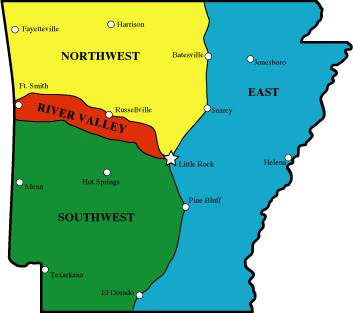
RIVER VALLEY REGION TRAILS
Northwest
Arkansas region trails - Ozark Mountains
Southwest Arkansas
region trails - Ouachita Mountains
Eastern Arkansas
region trails
NATIONAL FOREST TRAILS
Mt. Magazine Trail, Ozark
National Forest & Mount
Magazine State Park
-
Miles: 14.2 miles one way
-
Rating: Moderate
-
Allowed: Camping and Dogs, Bicycles are allowed on part of the trail
-
Map and Trail description available: Arkansas
Hiking Trails guidebook by Tim Ernst
-
Contact: Magazine Ranger District Phone 501-963-3076
Here is your chance to climb to the highest point in Arkansas. You can
drive most of the way up, but taking this trail from Cove Lake up to Mt.
Magazine is a much better way to do it. It is a total elevation gain of
1753í. Camping is allowed along the trail (out of sight of the trail).
Cove Lake Loop, Ozark
National Forest
-
Miles: 3.5
-
Rating: Easy to Moderate
-
Allowed: Bicycles and Dogs
-
Map and Trail description available: Arkansas
Hiking Trails guidebook by Tim Ernst
-
Contact: Magazine Ranger District Phone 501-963-3076
Here is an easy loop trail that circles Cove Lake, and makes for a great
afternoon stroll. There is pretty good fishing along the way too!
Stop and fish anywhere you like.
Spring Lake Trail, Spring Lake Recreation Area, Ozark
National Forest
-
Miles: 2.0
-
Rating: Easy
-
Allowed:
-
Map and Trail description available: None
-
Contact: www.fs.fed.us/oonf/ozark or Phone 479-963-3076
This two-mile loop trail takes you through scenic hardwood forests. Lots
of wildflowers too.
U.S. ARMY CORPS OF ENGINEERS TRAILS
Bona Dea Trails System, Corps
of Engineers
-
Miles: 3.5 miles outside loop
-
Rating: Easy
-
Allowed: Dogs
-
Map and Trail description available: Arkansas
Hiking Trails guidebook by Tim Ernst
-
Contact: Lake Dardanelle Phone 501-968-5008
This is one of Arkansasí most unique trail systems. Itís a fitness trail.
Itís a jogging trail. Itís a nature trail. Itís a hiking trail. Itís a
wildlife watching trail. Itís barrier free. And itís all within the city
limits of Russellville. The park covers 186 acres of wetland and low woods,
which provide one of the most productive ecosystems found anywhere.
Tollantusky Trail, Toad Suck Ferry, Cadron Settlement, Corps
of Engineers
-
Miles: 1.5 miles
-
Rating: Easy **A
portion of the trail is wheelchair accessible**
-
Allowed: Dogs
-
Map and Trail description available: Lake Manager, 6298 Hwy. 60 West, Conway,
AR 72032
-
Contact: Phone 501-329-2986
The Tollantusky Trail is located along the Arkansas River in the historic
Cadron Settlement. The trail begins just west of the entrance parking lot
and loops back to its starting point. This historic trail interprets Arkansas
and its settlers in the early 1800s. A short section of the trail is designed
to be barrier free. This section begins up the hill from the trailhead
and travels along the ridge to a point overlooking the Arkansas River.
River Bluff Nature Trail, Ozark Lake, Reed Mountain Park, Corps
of Engineers
-
Miles: 1.0
-
Rating: Moderate
-
Allowed: Dogs
-
Map and Trail description available: Lake Manager, COE, Ozark Lake Project
Office, 6042 Lock & Dam Rd, Ozark, AR 72949
-
Contact: Phone 479-667-2129
This self-guided trail is much as it was before man settled this country.
Beginning atop the high bluffs overlooking Ozark Lake,
it winds its way down to their base. The trail then makes its way along
the forest floor before traveling to the overlook shelter at
the top of the bluffs. From the overlook you have a view of the river
as it begins its journey through Arkansas. Enjoy the
displays at the overlook describing the history of the area.
Tower Heights Trail, Blue Mountain Lake Area, Corps
of Engineers
-
Miles: 1.0
-
Rating: Easy
-
Allowed: Dogs
-
Map and Trail description available: Park Manager, Rt. 1 Box
173-AA, Waveland, AR 72842
-
Contact: Phone 479-947-2372
A trip down the trail begins near the park entrance complex. This rustic
trail travels one mile through the forest along a ridge
overlooking Blue Mountain Lake. If you are interested in a guided tour
of the trail or would like more park information, please
contact the park ranger.
Bridge Rock Loop, Corps
of Engineers
-
Miles: six-tenths of a mile (.6)
-
Rating: Easy
-
Allowed: Dogs
-
Map and Trail description available: Arkansas
Hiking Trails guidebook by Tim Ernst
-
Contact: Lake Dardanelle Ph. 479-968-5008
This is one of the most scenic short trails in the state. There is a little
bit of climbing involved, but itís worth it! The trail is
located in Shoal Bay Park on Lake Dardanelle, just off of Hwy. 22.
ARKANSAS STATE PARKS TRAILS
Ouachita Trail, Pinnacle
Mountain State Park
-
Miles: 30
-
Rating: Moderate
-
Allowed: Dogs
-
Map and Trail description available: Ouachita
Trail guidebook by Tim Ernst
-
Contact: [email protected] or Phone
501-868-5806
The eastern terminus of the Ouachita National Recreation Trail begins in
Pinnacle Mountain State Park by the visitors center.
The trail heads west from there running through the park for about
3 miles. Pinnacle is responsible for managing the next 20
miles of this 223-mile trail.
Boy Scout Trail, Petit
Jean State Park
-
Miles: 12
-
Rating: Moderate-Difficult
-
Allowed: Dogs
-
Map and Trail description available: Visitor Center
-
Contact: Petit Jean State Park Phone 501-727-5441
The trail touches and connects all of the trails and follows large portions
of many of them. On this trail you will pass through
many of the diverse plant and animal habitats of Petit Jean, from the
lush vegetation of Cedar Creek to the desert like conditions
of sections of Seven Hollows. All are present on this trail. The trail
is long and difficult. Be sure you are prepared with food,
water, appropriate shoes and clothing and first aid. START THIS HIKE
EARLY SO YOU CAN SAFELY ENJOY THIS ALL
DAY WALK.
Mount Magazine Hiking Trail, Mount
Magazine State Park
-
Miles: 6.5
-
Rating: Moderate
-
Allowed: Dogs
-
Map and Trail description available: Arkansas
Hiking Trails guidebook by Tim Ernst
-
Contact: [email protected] or Phone 479-963-8502
Signal Hill and the Greenfield and East End picnic areas are near the summit
of this plateau-like mountain. From Cameron
Bluff, the trail winds down the mountain to a broad bench where virgin
oaks, gum and ash are found. This trail is listed in both
the day and overnight hiking sections due to the versatility offered
by the variety of access points, distances and terrain. This is
truly a unique mountain setting offering some of the most expansive
views in Arkansas.
Seven Hollows Loop, Petit
Jean State Park
-
Miles: 4.2
-
Rating: Moderate
-
Allowed: Dogs
-
Map and Trail description available: Arkansas
Hiking Trails guidebook by Tim Ernst
-
Contact: Petit Jean State Park Phone 501-727-5441
Itís got tons of bluffs, boulders, wildflowers and waterfalls. This is
a special scenic spot nearly every step of the way! The
bluffs there are made out of Hartshorne Sandstone. This rock contains
hard iron deposits which have ícaused it to weather at
varying rates and created a wide variety of colors and patterns on
the rock faces. A parking fee may be required-check with the
office.
Bench Trail, Mount
Nebo State Park
-
Miles: 4.0
-
Rating: Easy
-
Allowed: Mountain bikes, dogs, camping
-
Map and Trail description available: Arkansas
Hiking Trails guidebook by Tim Ernst
-
Contact: [email protected] or Phone 479-229-3655
The Bench Trail begins at the overlook shelter approached as you drive
up the mountain to the park. There is a narrow shelf
called a bench that encircles the entire mountain. In the early 1900s,
this bench was a road; now it is a trail through a woodland
that teems with large trees and wildlife. Fern lake, remnants of historic
springs, and steps that are a part of this early resort
development are still visible. The trail is level in most places and
sports fantastic mountain scenery, especially during seasons of
ìleaf-off.î
Rim Loop Trail, Mt.
Nebo State Park
-
Miles: 3.4
-
Rating: Moderate
-
Allowed: Dogs
-
Map and Trail description available: Arkansas
Hiking Trails guidebook by Tim Ernst
-
Contact: Mt. Nebo State Park Phone 479-229-3655
Rim Trail Loop-3.4 miles total. This trail circles the mountain on
top of, and sometimes at the base of, the bluff that runs the
entire way.
Pinnacle Mountain Summit Loop, Pinnacle
Mtn. State Park
-
Miles: 2.6
-
Rating: Difficult and steep
-
Allowed: Dogs
-
Map and Trail description available: Arkansas
Hiking Trails guidebook by Tim Ernst
-
Contact: [email protected] or Phone 501-868-5806
This is the steepest hiking trail in Arkansas-it limbs up the standing
spine of Pinnacle Mountain-the views and rock formations
are simply spectacular! There is no camping in the Park, but it does
offer a whole host of educational opportunities, and great
exhibits at the Visitor Center. A parking fee may be required-check
with the office. The park closes at 10pm.
Will Appleís Road, Mount
Magazine State Park
-
Miles: 2.3
-
Rating: Moderate
-
Allowed: Dogs
-
Map and Trail description available: Visitor Center
-
Contact: [email protected] or Phone 479-963-8502
Named after a farmer who cultivated several acres of corn on the northeastern
leg of the mountain, this was one of the first
roads to the summit. Features include: historic homesites, wildflowers,
escaped domestic flowers, woodland songbirds, stone
fences, and ruins of a swimming pool built in the 1920ís
Rocky Valley Trail, Pinnacle
Mountain State Park
-
Miles: 2.0
-
Rating: Moderate
-
Allowed: Dogs
-
Map and Trail description available: Visitor Center
-
Contact: [email protected] or Phone
501-868-5806
The trailhead starts at the same location as the Overlook Trail in the
upper parking lot of the visitor center. This 2-mile loop
enters into a heavily forested valley after leaving an old rock quarry
area.
Cedar Falls Trail, Petit
Jean State Park
-
Miles: 2.0
-
Rating: Easy down, steep back up
-
Allowed: Dogs
-
Map and Trail description available: Arkansas
Hiking Trails guidebook by Tim Ernst
-
Contact: Petit Jean State Park Phone 501-727-5441
The Cedar Falls Trail is one of the most used trails in the state, and
with good reason, since it takes you to one of the most
impressive waterfalls in this part of the country! The area is also
an ecological garden-lots and lots of neat plant life. One word
of caution-the last part of the hike out is pretty tough, and is not
recommended for anyone with problems climbing hills.
Mossback Ridge Trail, Mount
Magazine State Park
-
Miles: 2.0
-
Rating: Moderate
-
Allowed: Dogs
-
Map and Trail description available: Arkansas
Hiking Trails guidebook by Tim Ernst (part of Mt. Magazine Trail description)
-
Contact: [email protected] or Phone 479-963-8502
Mossback Ridge was named after Albert Morsbach, a settler, farmer, and
teacher. Most of the walking is easy on top of the
ridge. Watch for a variety of wildflowers and signs of bears moving
rocks and logs.
West Summit Trail, Pinnacle
Mountain State Park
-
Miles: 1.5 round trip
-
Rating: Difficult
-
Allowed: Dogs
-
Map and Trail description available: Arkansas
Hiking Trails guidebook by Tim Ernst (part of Pinnacle Mtn. Loop Trail
description)
-
Contact: [email protected] or Phone
501-868-5806
This rocky trail begins at the park picnic grounds and winds its way to
the top of Pinnacle Mountain. From the top is a
spectacular views of Lake Maumelle, the Arkansas River Valley, the
Ouachita Mountains and west Little Rock. This is truly a
breathtaking view. To return, you must retrace your steps or hike down
the rugged East Summit Trail and return via the base
trail for a total hike of 2 1/2 miles.
Signal Hill Trail, Mount
Magazine State Park
-
Miles: 1.5
-
Rating: Moderate
-
Allowed: Dogs
-
Map and Trail description available: Arkansas
Hiking Trails guidebook by Tim Ernst (part of Mt. Magazine Trail description)
-
Contact: [email protected] or Phone 479-963-8502
This is the highest point in Arkansas. A wide variety of plants make this
a nice nature walk.
Base Trail, Pinnacle
Mountain State Park
-
Miles: 1.25
-
Rating: Easy
-
Allowed: Dogs
-
Map and Trail description available: Arkansas
Hiking Trails guidebook by Tim Ernst (part of Pinnacle Mtn. Loop Trail
description)
-
Contact: [email protected] or Phone
501 868-5806
Starting at the north side of the Little Maumelle boat ramp at the far
end of the picnic area, this 1 1/4 mile trail one way curves
around the southeastern base of Pinnacle Mountain and connects with
the East Summit trailhead parking lot. The first portion
of the trail is fairly level and offers views of the river. Several
moderate slopes and a variety of plant life will be encountered.
Benefield Trail, Mount
Magazine State Park
-
Miles: 1.0
-
Rating: Easy to Moderate
-
Allowed: Dogs
-
Map and Trail description available: Visitor Center
-
Contact: [email protected] or Phone 479-963-8502
This trail leads through a CCC picnic area, which is now abandoned. Some
picnic structures are still evident. After crossing
Highway 309 the trail leads to a wildlife pond. This trail connects
with the Mossback Ridge Trail at the pond and loops back
via road to the picnic area. Watch for deer and bear.
Canyon Trail, Petit
Jean State Park
-
Miles: 1.0
-
Rating: Easy to Moderate
-
Allowed: Dogs
-
Map and Trail description available: Visitor Center
-
Contact: Petit Jean State Park or Phone
501-727-5441
Accessed from Cedar Falls Trail. Once crossing the bridge on the Cedar
Falls trail turn left and begin this beautiful hike into
Cedar Canyon. The trail follows Cedar Creekís many small splashing
falls and deep emerald pools. Car sized boulders have
slid down the hill and partially blocked the creekís path in many places.
Many sections of the trail are on terraces of rock put in
place by the CCC.
Greenfield Trail, Mount
Magazine State Park
-
Miles: 1.0
-
Rating: Easy to Moderate
-
Allowed: Dogs
-
Map and Trail description available: Visitor Center
-
Contact: [email protected] or Phone 479-963-8502
The Greenfield picnic area was a family farm before the Great Depression.
This trail crosses the headwaters of Big Shoal
Creek and connects to the Mossback Ridge Trail and is a good place
to start a longer trek across the park. Some hikers
continue all the way to Cove Lake for over night trips.
Summit Park Trail, Mount
Nebo State Park
-
Miles: 1.0
-
Rating: Moderate to Difficult
-
Allowed: Dogs
-
Map and Trail description available: Arkansas
Hiking Trails guidebook by Tim Ernst
-
Contact: [email protected] or Phone 479-229-3655
This loop trail begins at a point on the northwest side of the mountaintop.
Named for the Summit Park Hotel, built near the
trailhead in 1889, it meanders down to Fern Lake along the same path
that it has taken since it was first used by guests of the
famous hotel. The Civilian Conservation Corps improved the trail with
beautiful rock work in the 1930s. This trail intersects the
Bench Trail near Fern Lake. A self-guided trail brochure may be obtained
at the park visitor center.
Meadow Brook Self-Guided Trail, Lake
Dardanelle State Park
-
Miles: three-quarters of a mile (.75)
-
Rating: Easy
-
Allowed: Dogs
-
Map and Trail description available: Visitor Center
-
Contact: [email protected] or Phone 479-967-5516
The theme of the Meadow Brook Self-Guided Trail is change: the succession
of plants, manís influence on the environment,
and the variety of flowers, plants, and trees in the Arkansas River
Valley. The trail begins and ends near the park amphitheater.
Nebo Springs and Nebo Steps Trail, Mount
Nebo State Park
-
Miles: three-quarters of a mile (.75)
-
Rating: Difficult
-
Allowed: Dogs
-
Map and Trail description available: Visitor Center
-
Contact: [email protected] or Phone 479-229-3655
A delightful hike to moss covered Nebo Springs begins behind the visitor
center on the Rim Trail. Turn right onto Rim Trail
then down Nebo Steps to the Bench Road Trail. Turn right on the Bench
until you get to the sign for Nebo Springs. The climb
back up Nebo Springs trail, then right onto the Rim Trail. Completes
a rectangular circle. Highly recommended for the
historical significance and natural beauty.
East Summit Trail, Pinnacle
Mountain State Park
-
Miles: three-quarters of a mile (.75)
-
Rating: Moderate to Difficult
-
Allowed: Dogs
-
Map and Trail description available: Arkansas
Hiking Trails guidebook by Tim Ernst (part of Pinnacle Mtn. Loop Trail
description)
-
Contact: [email protected] or Phone
501-868-5806
The start of this trail is in the southeast corner of the parking lot.
Follow the red and white blazes. The trail will take you to the
east summit.
Arkansas Trail, Pinnacle
Mountain State Park
-
Miles: six-tenths of a mile (.6)
-
Rating: Easy **Wheelchair
accessible**
-
Allowed: Dogs
-
Map and Trail description available: Visitor Center
-
Contact: [email protected] or Phone
501-868-580
This paved loop trail with numerous benches is the center of the 71-acre
Arkansas Arboretum. Audio sign panels interpret the
variety of woody plants and trees found in the six natural divisions
of Arkansas.
Varnell Springs Trail, Mount
Nebo State Park
-
Miles: one-half of a mile (.5)
-
Rating: Moderate
-
Allowed: Dogs
-
Map and Trail description available: Visitor Center
-
Contact: [email protected] or Phone 479-229-3655
This trail winds through natural features, a diverse forest and many wildflowers.
The spring was once the water supply for the
town of Dardanelle. Some of the old water pipes remain visible.
East Quarry Trail, Pinnacle
Mountain State Park
-
Miles: one-half of a mile (.5)
-
Rating: Moderate to Difficult
-
Allowed: Dogs
-
Map and Trail description available: Visitor Center
-
Contact: [email protected] or Phone
501-868-5806
This trail is a spur from the Rocky Valley Trail. It leads to the eastern
portion of the park and climbs a steep hillside to another
quarry area which offers a rock-lined overlook with dramatic vistas
of Pinnacle Mountain and the Arkansas River Valley. The
trail is 1 mile round trip from the Rocky Valley spur.
Kingfisher Trail, Pinnacle
Mountain State Park
-
Miles: one half of a mile (.5)
-
Rating: Easy **Wheelchair
accessible**
-
Allowed: Dogs
-
Map and Trail description available: Visitor Center
-
Contact: [email protected] or Phone
501-868-5806
This hard-surfaced loop trail winds through the floodplain of the Little
Maumelle River. Unique plants, wildflowers, animals
and birds are easily visible. Along the river, large cypress trees
filter sunlight into this special bottomland forest. Birdwatchers
enjoy exploring this trail early in the morning.
Waterfall/Gum Springs Trail, Mount
Nebo State Park
-
Miles: one-quarter of a mile (.25)
-
Rating: Moderate to Difficult
-
Allowed: Dogs
-
Map and Trail description available: Visitor Center
-
Contact: [email protected] or Phone 479-229-3655
Developed by the CCC in the 1930ís using only hand labor and mules, this
trail passes the seasonal waterfall enroute from the
Waterfall Overlook to Gum Springs. The trail is very steep with many
switchbacks and huge rock steps.
Bear Cave Trail, Petit
Jean State Park
-
Miles: one-quarter of a mile (.25)
-
Rating: Easy
-
Allowed: Dogs
-
Map and Trail description available: Visitor Center
-
Contact: [email protected] or Phone 501-727-5441
No actual cave is here but you can walk between and through the high rocks
in the area. They form a series of narrow
passageways and shelters. Bear Cave was named when the last bear killed
on Petit Jean Mountain met its end. The cathedral of
rock running down the center of the loop is believed to have been formed
by Cedar Creek long ago. This passageway is called
ìThe Eye of the Needleî
Rock House Cave Trail, Petit
Jean State Park
-
Miles: one-quarter of a mile (.25)
-
Rating: Easy
-
Allowed: Dogs
-
Map and Trail description available: Visitor Center
-
Contact: Petit Jean State Park or Phone 501-727-5441
Rock House Cave is not a true cave but a large rock shelter. Rock House
contains evidence that Native Americans once lived on
or near Petit Jean Mountain many years ago. Look closely for the faint
remains of pictographs high on the wall and imagine
what they mean. As you turn to the parking lot notice the large turtle
rocks on whose backs you are walking.
Scenic Overlook Trail. Pinnacle
Mountain State Park
-
Miles: three-hundredths of a mile (.03)
-
Rating: Easy to Moderate
-
Allowed: Dogs
-
Map and Trail description available: Visitor Center
-
Contact: [email protected] or Phone
(501)868-5806
To reach the trailhead, start from the east corner of the upper parking
lot. Follow the main trail to the first intersection and turn
left up the flight of stairs. The overlook is 75 yards from the parking
lot. You will find the scenic views of the Arkansas River
Valley, Pinnacle Mountain and Lake Maumelle. It is an excellent location
for observing migrating hawks in the fall.
Back to TOP OF PAGE
SOUTHWEST
ARKANSAS REGION TRAILS
Northwest
Arkansas region trails - Ozark Mountains
Arkansas River
Valley region trails
Eastern Arkansas
region trails
NATIONAL FOREST TRAILS
Ouachita Trail, Ouachita
National Forest and Queen Wilhelmina & Pinnacle Mtn. State Parks
-
Miles: 222.5 miles one way (first 50 miles are in Oklahoma)
-
Rating: Easy to Difficult
-
Allowed: Camping and Dogs
-
Map and Trail description available: Ouachita
Trail Guide by Tim Ernst
-
Contact: Ouachita National Forest Phone 501-321-5202
This is the longest hiking trail in Arkansas. Actually, it begins in Oklahoma,
at Talimena State Park, runs across the full length of the Ouachita National
Forest, and ends up at Pinnacle Mountain State Park near Little Rock. The
Ouachita Trail (OT) is a true long-distance backpacking trail. It also
has a number of spur and loop trails that join it, plus lots of other access,
so itís great for dayhiking as well. Much of this trail runs along high
ridgetops, with great views out across the countryside. But it sees its
share of other special scenic spots (SSS) areas too, like wilderness areas,
streams, springs and lush hillsides. There is a multitude of geological
formations-rock gardens and glaciers, moss-covered boulders, and strange
looking outcrops dot the landscape.
Womble Trail, Ouachita
National Forest
-
Miles: 39.5 one way
-
Rating: Easy to Moderate
-
Allowed: Camping and Dogs, heavy bicycle use on most of the trail
-
Map and Trail descriptions available: Arkansas
Hiking Trails guidebook by Tim Ernst
-
Contact: Oden Ranger District Phone 870-326-4322
This is the third longest trail in Arkansas. The views are breathtaking,
and there are lots and lots of large trees along the way. There are a number
of hefty climbs, but for the most part the trail is a pleasure to hike.
Most of the trail is in the Ouachita National Forest, so camping is allowed
along the route, and there are three short spur trails down to campgrounds
on the Ouachita River. Watch out for heavy mountain bike traffic - this
has become one of the main bike trails in this part of the United States.
Eagle Rock Loop, Ouachita
National Forest
-
Miles: 26.8
-
Rating: Easy to Difficult
-
Allowed: Camping and Dogs, Horses are allowed on the Viles Branch
section.
-
Map and Trail description available: Arkansas
Hiking Trails guidebook by Tim Ernst
-
Contact: Caddo Ranger District Phone 870-356-4186
This is the longest loop hike in Arkansas. It is actually a combination
of three trails (the Little Missouri, the Athens-Big Fork, and part of
the Viles Branch Horse Trail). It loops through a large chunk of the Ouachita
National Forest southwest of Hot Springs. This makes a perfect weekend
trail, or even a nice three-day hike.
Little Blakely Loops, Ouachita
National Forest
-
Miles: 18.6 miles total
-
Rating: Easy to Moderate
-
Allowed: Camping, dogs and bicycles
-
Map and Trail description available: Arkansas
Hiking Trails guidebook by Tim Ernst
-
Contact: Jessieville Ranger District Phone 501-984-5313
There are actually five loops that all connect here, allowing a variety
of lengths of hikes. Each loop has its own unique features, from glades,
to boulder fields, to giant trees. The entire area is located in the Ouachita
National Forest, so camping is allowed.
South and Big Tree Loops-10.2 miles total
Rocky Ridge Loop-2.5 miles total
Glades Loop-1.8 miles total
Morgan Hollow Loop-4.1 total
Little Missouri Trail, Ouachita
National Forest
-
Miles: 15.7 miles one way
-
Rating: Easy to Moderate
-
Allowed: Camping and dogs
-
Map and Trail description available: Arkansas
Hiking Trails guidebook by Tim Ernst
-
Contact: Caddo Ranger District Phone 870-356-4186
This is one of the most scenic and easy backpacking trails in Arkansas.
It follows the Little Missouri River, which is a National Wild and Scenic
River, passes Little Missouri Falls, follows along a historic wagon trail,
and goes through the Winding Stairs area, which has perhaps the best swimming
hole anywhere! This is an especially good trail to hike during the summer,
since the river always has water in it.
Black Fork Mountain Wilderness Trail, Ouachita
National Forest
-
Miles: 11.6 round trip
-
Rating: Moderate to Difficult
-
Allowed: Camping and Dogs
-
Map and Trail description available: Arkansas
Hiking Trails guidebook by Tim Ernst
-
Contact: Mena Ranger District Phone 501-394-2382
This mountain-top wilderness trail has some incredible views up and down
the upper Ouachita River and Big Creek valleys, and the Rich Mountain/Talimena
Scenic Drive area across the way. The route of this trail (much of it on
old roads) gets pretty steep at times-this is a tough trail-but the rewards
are certainly worth it. There is very little water along the route, so
be sure to carry plenty. Also, there is a healthy black bear population
in the area, so be a good clean camper, donít leave food in your tent,
and be alert! If you are a real strong hiker, you could dayhike this trail.
I would recommend that you backpack it, though, and spend the night somewhere
near the end of the trail-just take it easy as you go up, and enjoy the
views.
Caney Creek Trail, Caney Creek Wilderness, Ouachita
National Forest
-
Miles: 9.6 miles one way
-
Rating: Moderate
-
Allowed: Camping, Dogs, and Horses
-
Map and Trail description available: Arkansas
Hiking Trails guidebook by Tim Ernst
-
Contact: Mena Ranger District Phone 501-394-2382
This is one of the best trails in Arkansas. Most of it runs along picturesque
Caney Creek, and crosses the Caney Creek Wilderness Area from end to end.
The only drawback to this trail is that it fords the creek many times,
and crosses the Cossatot River on the west end (much larger than Caney
Creek)-itís a great trail to hike in the summer, when you donít mind getting
your feet wet!
Athens-Big Fork Tail, Ouachita
National Forest
-
Miles: 9.1 one way
-
Rating: Moderate to Difficult
-
Allowed: Camping and Dogs
-
Map and Trail description available: Arkansas
Hiking Trails guidebook by Tim Ernst
-
Contact: Caddo Ranger District Phone 870-356-4186
This is one of the most unique trails in the state. It was built
over a hundred years ago as a mail route between the communities of Athens
and Big Fork. It is a steep, tough trail, but if you can make it,
the trip is worth it for the views alone-especially during leaf-off, when
itís hard to keep your eyes on the trail!
Hole in the Ground Mountain Trail, Ouachita
National Forest
-
Miles: 7.3 round trip
-
Rating: Moderate
-
Allowed: Camping and Dogs
-
Map and Trail description available: Arkansas
Hiking Trails guidebook by Tim Ernst
-
Contact: Cold Springs Ranger District Phone 501-675-3233
This trail is a bit of a sleeper-not too many folks know about or hike
it. The first section of the trail looks down into a remarkable horseshoe
bend in Jack Creek, and later on there are some terrific views out across
the mountains. The first section of this trail gets pretty steep, but does
level off on top of the ridge after a while. This is a good trail to use
to access the Dry Creek Wilderness nearby if youíre looking for a longer
hike into the area.
Brushy Creek Loop, Ouachita
National Forest
-
Miles: 6.9
-
Rating: Moderate
-
Allowed: Camping and Dogs
-
Map and Trail descriptions available: Arkansas
Hiking Trails guidebook by Tim Ernst
-
Contact: Oden Ranger District Phone 870-326-4322
There are several trails in the area of Big Brushy Campground in the Ouachita
National Forest, which is located on Hwy. 270 between Y-City and Mt. Ida.
One of them, the Brushy Trail, connects with a portion of the Ouachita
Trail and makes a nice loop. The trail begins at the very back of the campground
there, and is blazed with white paint. And with the exception of one long,
steep grade, itís a real easy trail to hike.
Tall Peak Trail, Ouachita
National Forest
-
Miles: 6.4 round trip
-
Rating: Moderate
-
Allowed: Camping and dogs
-
Map and trail description available: Arkansas
Hiking Trails guidebook by Tim Ernst
-
Contact: Mena Ranger District Phone 501-394-2382
This trail does just exactly what you think it does-it climbs up to the
tallest peak in the area, which is 2330 feet tall, and is called Tall Peak.
But it also runs along a wonderful little stream, crossing it four times.
Winding Stairs Trail, Albert Pike Recreation Area, Ouachita
National Forest
-
Miles: 5.25 miles one way
-
Rating: Moderate
-
Allowed: Camping and dogs
-
Map and Trail description available: Caddo Ranger District,
912 Smokey Bear Lane, Glenwood, AR 71943
-
Contact: www.fs.fed.us/oonf/ouachita or Phone 870-356-4186
This trail follows the Little Missouri River and allows access to an area
known for its scenic beauty, popular swimming holes and challenging fishing
opportunities. There are cascading waterfalls, abundant wildflowers and
impressive spring and fall colors which contribute to the popularity of
this trail. The trail provides several spectacular overlooks of the river.
The most scenic spot on the trail is where Raven Branch flows into the
river. There are large novaculite outcroppings overlooking the river which
make this a popular spot for photographers. This trail is popular
with both day and overnight hikers. This trail, combined with the Little
Missouri Trail, provides about 16 miles of trail along the Little Missouri
River.
Buckeye Mountain Trail, Ouachita
National Forest
-
Miles: 4.6
-
Rating: Moderate
-
Allowed:
-
Map and Trail description available: Arkansas
Hiking Trails guidebook by Tim Ernst
-
Contact: www.fs.fed.us/oonf/ouachita or Phone
479-394-2382, Mena Ranger District, 1603 Hwy. 71 North, Mena,
AR 71953
The Buckeye Mountain Trail is a short spur trail which connects with the
Caney Creek Trail at its midpoint. It is primarily a ridgetop trail through
the Caney Creek Wilderness area which offers magnificent views into the
Caney Creek watershed. The Buckeye Trail, combined with the Caney Creek
Trail, can provide a good day-long loop hike or a versatile overnight hike.
Hunts Loop, Ouachita
National Forest
-
Miles: 4.3
-
Rating: Moderate
-
Allowed: Camping and Dogs
-
Map and Trail description available: Arkansas
Hiking Trails guidebook by Tim Ernst, Mena Ranger District, 1603
Hwy. 71 North, Mena, AR 71953
-
Contact: Jessieville Ranger District Phone
501-984-5313
This nice loop trail begins at the Iron Springs Recreation Area, climbs
up Short Mountain, then connects with the Ouachita Trail and loops back
around to the beginning. Itís got some great views, visits stand of big
trees, and passes by some neat streamside areas.
Charlton Trail, Ouachita
National Forest
-
Miles: 4.2 miles one way
-
Rating: Easy to Moderate
-
Allowed: Camping, Dogs and Bicycles
-
Map and Trail description available: Arkansas
Hiking Trails guidebook by Tim Ernst, Mena Ranger District, 1603
Hwy. 71 North, Mena, AR 71953
-
Contact: Womble Ranger District Phone 870-867-2101
There are a couple of pretty good climbs, nice views, and a spring half
way. It begins at Charlton Recreation Area on Hwy. 270 between Hot Springs
and Mt. Ida. There is a swimming lake there, campground and picnic area,
but it is closed during the winter, which will add some to your hike.
Lake Sylvia Loop, Ouachita
National Forest
-
Miles: 4.1
-
Rating: Easy
-
Allowed: Dogs, camping in campground
-
Map and Trail description available: Arkansas
Hiking Trails guidebook by Tim Ernst, Mena Ranger District, 1603
Hwy. 71 North, Mena, AR 71953
-
Contact: Winona Ranger District Phone 501-889-5176
This trail, west of Little Rock, connects with a part of the Ouachita Trail
and an interpretive trail, overlooks a spectacular rock canyon area, and
loop back along the shores of Lake Sylvia to the trailhead. It is located
in the Ouachita National Forest. Itís great for dayhiking.
Sugar Creek Trail, Ouachita
National Forest
-
Miles: 3.5
-
Rating: Difficult
-
Allowed:
-
Map and Trail description available: none
-
Contact: Cold Springs Ranger District Phone
501-675-3233
The trail connecting Knoppers Ford Recreation Area to Jack Creek Recreation
Area covers challenging terrain offering excellent views of the Sugar,
Middly and Jack Creek drainages and surrounding countryside. A short day
hike on the trail allows visitors to view abundant wildlife, interesting
geological formations and pine/hardwood forests.
Shady Lake Trail, Mena Ranger District, Ouachita
National Forest
-
Miles: 3.1
-
Rating: Easy
-
Allowed:
-
Map and Trail description available: None
-
Contact: Mena Ranger District Phone 501-394-2382
The CCC developed the Shady Lake Recreation Area in 1937. The Shady Lake
trail traverses Saline Creek and passes the historic Shady Lake Dam. It
continues along the opposite side of the lake up West Saline Creek. The
trail is ideal for day hiking. Mountain bikers may also use the trail.
Wildlife Trail, Lake Sylvia Recreation Area, Ouachita
National Forest
-
Miles: 2.33 miles
-
Rating: Moderate to Difficult
-
Allowed:
-
Map and Trail description available: Winona Ranger District,
1069 N. Fourche, Perryville, AR 72126
-
Contact: www.fs.fed.us/oonf/ouachita or Phone 501-889-5176
This trail consists of two loops and a spur trail. Loop A is a one-mile
wildlife interpretive trail that returns by the Lake Sylvia dam and affords
a beautiful vies of Narrow Creek and its bluffs. Loop B starts on the back
side of Loop A and affords a nice vista of the east fork of Narrow Creek
and Lake Sylvia. This loop returns to Loop A, and their length totals 1
1/2. The 3/4-mile spur up Chinquapin Mountain begins on the back side Loop
B. The top of the mountain presents a 270-degree panoramic view, including
Lake Maumelle and Flatside Pinnacle. This trail complex has short grades
in excess of 10 percent, but its views are more than worth the effort.
Earthquake Ridge Trail, Ouachita
National Forest
-
Miles: 2.1
-
Rating: Easy to Moderate
-
Allowed: Camping, Bicycles and Dogs
-
Map and Trail description available: Arkansas
Hiking Trails guidebook by Tim Ernst
-
Contact: Mena Ranger District Phone 501-394-2382
This short loop trail is one of two that is located at the Mena Visitor
Center of the Forest Service, which is just west of Mena on hwy 88 up on
the Talimena Scenic Byway. It is used by mountain bikes once in a while.
Serendipity Loop, Ouachita
National Forest
-
Miles: 1.0
-
Rating: Easy
-
Allowed: Dogs
-
Map and Trail description available: Arkansas
Hiking Trails guidebook by Tim Ernst
-
Contact: Oden Ranger District Phone 870-326-4322
This is a very short, easy to hike, and the signs there interpret the forest
like no other trail. Itís in the Ouachita National Forest, right across
from the Oden District Rangerís Office. Definitely worth a side trip to
go see.
Tree Of The Forest Trail, Lake Sylvia Recreation Area, Ouachita
National Forest
-
Miles: 1.0 mile round trip
-
Rating: Easy **Wheelchair
accessible**
-
Allowed:
-
Map and Trail description available: Winona Ranger District,
1069 N. Fourche, Perryville, AR 72126
-
Contact: www.fs.fed.us/oonf/ouachita or Phone 501-889-5176
This tree identification interpretive trail begins at the parking lot just
past the Lake Sylvia camping entrance. The first half of the trail has
an asphalt surface, and is an easy walk across the hardwood floodplain
of Narrow Creekís east forks. This part of the trail is easily negotiable
by wheelchairs. The second half has a gravel surface with grades up to
5 percent. This section is equipped with a wooden cane rail along the base
of the trail for the visually impaired.
Friendship Interpretive Loop, Ouachita
National Forest
-
Miles: nine-tenths of a mile (.9)
-
Rating: Easy
-
Allowed: Dogs
-
Map and Trail description available: Arkansas
Hiking Trails guidebook by Tim Ernst
-
Contact: Jessieville Ranger District Phone 501-984-5313
This is a beautiful little trail that is paved and is barrier free. It
loops around through the woods behind the Forest Service Visitor Center
at Jessieville. Take your lunch with you and stop at one of the many benches
or picnic tables and enjoy some time outside.
Prayer of the Woods Trail, Charlton Recreation Area, Ouachita
National Forest
-
Miles: three-fourths of a mile (.75)
-
Rating: Easy
-
Allowed:
-
Map and Trail description available: Womble Ranger District,
1523 U.S. 270 East, Mt. Ida, AR 71957
-
Contact: www.fs.fed.us/oonf/ouachita or Phone 870-867-2101
An easy one-hour hike along this interpretive trail allows visitors to
see many of the 55 species of plants native to the area. Interpretive signs
are located at key interest points. This loop trail was developed by the
Forest Service as a cooperative project with the Arkansas Federation of
Garden Clubs, Inc. and the Weyerhaeuser Foundation.
Crystal Recreation Area Loop, Ouachita
National Forest
-
Miles: seven-tenths of a mile (.7)
-
Rating: Easy
-
Allowed: Dogs
-
Map and Trail description available: Arkansas
Hiking Trails guidebook by Tim Ernst
-
Contact: Caddo Ranger District Phone 870-356-4186
This is another short, seldom used, easy trail that loops around through
some huge eighty-year-old trees.
Orchard Trail, Mena Ranger District, Ouachita
National Forest
-
Miles: one-half of a mile (.5)
-
Rating: Easy **Wheelchair
Accessible**
-
Allowed:
-
Map and Trail description available:
-
Contact: Mena Ranger District Phone 501-394-2382
This accessible trail meanders through the picturesque pine and hardwood
forest surrounding the Talimena Scenic Byway Visitor Information Station
near Mena. This short hike features the ruins of an abandoned home site
with a viewing deck and benches. This trail and all site facilities allow
easy access for all visitors including those physically challenged.
A Valuable Forest Trail, Shady Lake Recreation Area, Ouachita
National Forest
-
Miles: one-half of a mile (.5)
-
Rating: Easy
-
Allowed:
-
Map and Trail description available: Caddo Ranger District,
912 Smokey Bear Lane, Glenwood, AR 71943
-
Contact: www.fs.fed.us/oonf/ouachita or Phone 870-356-4186
This is an interpretive trail. Etched metal signs along the trail tell
how the forest was formed and describe the relationships between weather,
rocks, soil and the plants growing in the area. The trail is an easy walk
along the east fork of the Saline River. Many hikers cool their feet in
the streamís numerous pools.
Crystal Mountain Scenic Area Loop, Ouachita
National Forest
-
Miles: one half of a mile (.5)
-
Rating: Easy
-
Allowed: Dogs
-
Map and Trail description available: Arkansas
Hiking Trails guidebook by Tim Ernst
-
Contact: Caddo Ranger District Phone 870-356-4186
This is short, little used, easy trail that goes by old, old trees in the
Ouachita National Forest.
NATIONAL PARKS TRAILS
Sunset Loop, Hot
Springs National park
-
Miles: 8.0
-
Rating: Moderate
-
Allowed: No Dogs
-
Map and Trail description available: Arkansas
Hiking Trails guidebook by Tim Ernst
-
Contact: Hot Springs National Park Phone 501-624-3383
This ridgetop trail in Hot Springs National Park overlooks the city of
Hot Springs. There are lots of great views as the trail goes along the
crest of West, Music and Sugarloaf mountains, big trees, and even some
geological formations. There are actually a lot trails that wind around
the hills of Hot Springs. This is one of the best! And when you get done,
you can go get a massage and soak your tired feet!
The Grande Promenade,
Hot Springs National Park
-
Miles: one-third of a mile (.33)
-
Rating: Easy **Wheelchair
accessible**
-
Allowed: Dogs
-
Map and Trail description available: National Park Visitor Center
-
Contact: www.nps.gov/hosp or Phone 501-624-3383
**CURRENTLY CLOSED FOR CONSTRUCTION**
The Grande Promenade is a brick-paved trail that divides the city development
from Hot Springs mountain. Along the trail are many benches, native and
ornamental plants, an abundance of birds, and hot springs. Several scenic
overlooks allow views of the city and the Ouachita Mountains. This is a
really nice and wide sidewalk that takes you up and away from the busy
Bathhouse Row.
U.S. ARMY CORPS OF ENGINEERS TRAILS
Forest Hills Trail, Nimrod Lake Corps Office, Corps
of Engineers
-
Miles: 1.5
-
Rating: Easy to Moderate
-
Allowed:
-
Map and Trail description available:
-
Contact:
The trailhead starts on the south side of Nimrod Dam and meanders through
the wooded hills and valleys. Along the trail there are 18 points of interest,
which are explained in the trail guide. These points of interest range
from trees to vegetation to history of the area. Along the trail, you will
cross a foot bridge, be able to view the dam from the hill above and see
the Highway 7 Fourche River bridge from a scenic bluff above the river.
Arlie Moore Interpretive Trail, DeGray Lake Area, Corps
of Engineers
-
Miles: 1.33 mile
-
Rating: Easy
-
Allowed:
-
Map and Trail description available: Corp of Engineers Visitor Center
-
Contact: Phone 870-246-5501
This trail has an interconnecting loop which allows you to cut the hike
in half. The focus of the trail is the natural environment. Numbered posts
correspond to a trail booklet and describe tree species, timber management
and animals.
ARKANSAS STATE PARKS TRAILS
Lake Catherine Loop, Lake
Catherine State Park
-
Miles: 9.5 total for three trails
-
Rating: Easy to Moderate
-
Allowed: Dogs
-
Map and Trail description available: Arkansas
Hiking Trails guidebook by Tim Ernst
-
Contact: Lake Catherine State Park Phone 501-844-4176
There are three trails at this State Park. All of them are quite scenic,
and spend some time running along or looking down on lake Catherine. There
are lots of rock formations, lush vegetation, big trees, and a great waterfall.
A parking/entrance fee may be required.
Wildlife Lane, Millwood
State Park
-
Miles: 4.0
-
Rating: Easy
-
Allowed: Dogs, Bicycles
-
Map and Trail description available: Arkansas
Hiking Trails guidebook by Tim Ernst
-
Contact: [email protected] or Phone 870-898-2800
The path takes advantage of an area that floods periodically thus the trail
is closed at times. This is a multi-user trail with hikers having the right
of way.
Caddo Bend Loop, Lake
Ouachita State Park
-
Miles: 3.9
-
Rating: Easy
-
Allowed: Dogs
-
Map and Trail description available: Arkansas
Hiking Trails guidebook by Tim Ernst
-
Contact: Lake Ouachita State Park Phone 501-767-9366
This trail is located at Lake Ouachita State Park near Hot Springs. Itís
an easy trail that loops around a peninsula that sticks out into Lake Ouachita,
the largest lake in Arkansas. Since it follows closely to the shoreline,
this is a great trail to hike in the summer-just hop in when you get hot!
This park has several campgrounds and cabins available. They also have
some unique summer programs-check in at the Visitor Center. A parking/entrance
fee to hike may be required-ask at the Visitor Center.
Coastal Plains Trail, White
Oak Lake State Park
-
Miles: 3.0
-
Rating: Easy
-
Allowed: Dogs
-
Map and Trails description available: Arkansas
Hiking Trails guidebook by Tim Ernst
-
Contact: White Oak Lake State Park Phone 870-685-2748
This trail is a 3 mile spur/loop from the southeast corner of the Beech
Ridge Trail, which meanders through some of southern Arkansasís most unique
terrain. Look for Arkansas Oak, Loblolly Pine, and other unusual members
of the sandhills community along this scenic trail. As you walk near the
lake watch for great blue herons, green herons and great egrets.
White Oak Lake Loop Trail, White
Oak Lake State Park
-
Miles: 2.0
-
Rating: Easy
-
Allowed: Dogs
-
Map and Trails description available: Arkansas
Hiking Trails guidebook by Tim Ernst
-
Contact: White Oak Lake State Park Phone 870-685-2748
This trail is certainly in an out of the way place (White Oak Lake State
Park-east of Hope), but I think itís worth the effort to get there. I canít
quite put my finger on it, but there is a certain wonderful feeling that
you get as you walk the first section of this trail. Maybe itís the huge,
towering trees all around you. I donít know. But itís nice. This is a pretty
easy trail to hike. The loops is actually tow trails joined together-the
Beech Ridge and Coastal Plains trails. The short Spring Branch Nature Trail
at the park is also worth a look.
Daisy Creek Trail, Daisy
State Park
-
Miles: 2.0
-
Rating: Easy to Moderate
-
Allowed: Dogs
-
Map and Trail description available:
-
Contact: [email protected] or Phone 870-398-4487
Wooded areas and lakeshore views. Trail wanders through a variety of terrain
of mixed pine and hardwood. For a short distance along the lake. Goes through
two areas on lowland type terrain and over hilly areas. Connect with and
some times overlapping with 32 miles of Multi-Use trail in area.
Waterfowl Way Trail, Millwood
State Park
-
Miles: 1.5
-
Rating: Easy
-
Allowed: Dogs
-
Map and Trail description available: Arkansas
Hiking Trails guidebook by Tim Ernst
-
Contact: Millwood State Park Phone 870-898-2800
This unique trail at Millwood State Park is the only one in Arkansas where
you have a chance to see an alligator! Plus there is lots of other wildlife
to see, like a beaver lodge, and of course a bunch of waterfowl, including
blue herons, white egrets, bald eagles, geese, and tons of ducks. The park
is located on Hwy. 32 between Ashdown and Sartoga in extreme southwest
Arkansas. There is a nice campground there, and a marina. An entrance fee
may apply.
River Trail, Crater
of Diamonds State Park
-
Miles: 1.3 miles
-
Rating: Easy
-
Allowed: dogs
-
Map and Trail description available: None
-
Contact: [email protected] or Phone 870-285-3113
The trail begins at the campground, meanders through the pine/hardwood
forest to the Little Missouri River. The trail then loops back through
the forest to the trailhead.
Prospector Trail, Crater
of Diamonds State Park
-
Miles: 1.2
-
Rating: Easy
-
Allowed: Dogs
-
Map and Trail description available: Visitor Center
-
Contact: [email protected] or Phone 870-285-3113
The trail begins at the campground, meanders through the pine/hardwood
forest to the Little Missouri River. The trail then loops back through
the forest to the trailhead.
Loversí Leap Loop, Queen
Wilhelmina State Park
-
Miles: 1.1
-
Rating: Easy
-
Allowed: Dogs
-
Map and Trail description available: Arkansas
Hiking Trails guidebook by Tim Ernst
-
Contact: Queen Wilhelmina State Park Phone 501-394-2863
This short loop is located high atop Rich Mountain in Queen Wilhelmina
State Park (lodge and other facilities there), on the Talimena Scenic Drive,
about 14 miles from Mena. The trailhead is located behind the lodge, around
to the left.
Island Trail, DeGray
Lake Resort State Park
-
Miles: 1.0
-
Rating: Easy
-
Allowed: Dogs
-
Map and Trail description available: Visitor Center or Lodge
-
Contact: [email protected] or Phone
501-865-2801
The trail begins near the front entrance of the lodge. The first 75-100
yards lead to a road crossing, the trail splits into a loop which circles
back to the beginning. Hardwoods predominate the forest canopy. The trail
is located 50-60 feet from the lakeshore and provides the opportunity for
solitude and scenic beauty.
Green Heron Trail, DeGray
Lake Resort State Park
-
Miles: three-quarters of a mile (.75)
-
Rating: Easy
-
Allowed: Dogs
-
Map and Trail description available: Visitor Center or Lodge
-
Contact: [email protected] or Phone
501-865-2801
For the bird watcher, this trail offers some of the best viewing opportunities
in the park. The wildlife viewing station along the trail offers an excellent
vantage point for spotting eagles and waterfowl. The trail begins at the
Visitor Center.
Brushy Creek Trail, Cossatot
State Park
-
Miles: three-quarters of a mile (.75)
-
Rating: Moderate **Wheelchair
Accessible**
-
Allowed: Dogs
-
Map and Trail description available: None
-
Contact: [email protected] or Phone 870-385-2201
The trail provides a walk along a very interesting part of the Cossatot
River. The trail starts on the west side river access adjacent to State
Highway 246. It goes across the river on a large pedestrian bridge. Once
across the bridge follow the boardwalk around and across the east side
access road. Here you will climb a series of steps and enter a forested
ridge. The trail takes you along this wooded ridge where the river makes
a big looping horseshoe. This trail loops around and brings you to
the Brushy Creek Picnic Area, very popular day use area.
Crane Fly Trail, Logoly
State Park
-
Miles: three-quarters of a mile (.75)
-
Rating: Moderate
-
Allowed: Dogs
-
Map and Trail description available: Visitor Center
-
Contact: [email protected] or Phone 870-695-3561
The trail leads you by a small pond and several woodland streams. A boardwalk
crosses over the pond at one location, and the trail offers excellent opportunities
for plant and wildlife observation.
Chickadee Trail, DeGray
Lake Resort State Park
-
Miles: one-half of a mile (.5)
-
Rating: Easy
-
Allowed: Dogs
-
Map and Trail description available: Visitor Center
-
Contact: [email protected] or Phone 501-865-2801
This trail begins behind the Park Store near the tennis courts. This loop
trail takes you through a pine forest down along the shoreline. It is a
wonderful trail for anyone interested in seeing waterfowl and wading birds,
as well as those favoring pine forests.
Towering Pines Trail, DeGray
Lake Resort State Park
-
Miles: one-half of a mile (.5)
-
Rating: Easy to Moderate
-
Allowed: Dogs
-
Map and Trail description available: Visitor Center or Lodge
-
Contact: [email protected] or Phone
501-865-2801
This loop trail meanders through the mixed pine and hardwood forest to
the lakeshore and returns to its point of origin. It is particularly spectacular
in the spring as it displays an abundance of dogwood trees.
Dogwood Trail, Lake
Ouachita State Park
-
Miles: one-half mile (.5)
-
Rating: Easy
-
Allowed: Dogs
-
Map and Trail description available: Visitor Center
-
Contact: [email protected] or Phone 501-767-9366
This is a loop trail which leads hikers in to the National Forest surrounding
the Lake. There are 12 interpretive signs explaining the forest equality.
Spring Trail, Queen
Wilhelmina State Park
-
Miles: one-half mile (.5)
-
Rating: Easy
-
Allowed: Dogs
-
Map and Trail description available: Visitor Center
-
Contact: Queen Wilhelmina State Park Phone 501-394-2863
Beginning behind the stage at the amphitheater youíll walk west 100 yards
to the spring. This was a favorite gathering place for early mountain settlers
and is still a great oasis of relaxation and reflection. The trail continues
past the spring for about 1/2 mile and comes out on State Highway 88 across
from the west end of the campground.
Reservoir Trail, Queen
Wilhelmina State Park
-
Miles: one-third of a mile (.33)
-
Rating: Moderate
-
Allowed: Dogs
-
Map and Trail description available: Visitor Center
-
Contact: Queen Wilhelmina State Park Phone 501-394-2863
This trail begins at the lodge at the stairs and continues 1/3 of a mile
down the hill to a stone reservoir. The reservoir was part of the water
system for the 1898 hotel. Just up the hill from the reservoir is an excellent
spring that was said to have curative powers.
Spring Branch Trail, White
Oak Lake State Park
-
Miles: one-third of a mile (.33)
-
Rating: Easy
-
Allowed: Dogs
-
Map and Trails description available: Visitor Center
-
Contact: White Oak Lake State Park Phone 870-685-2748
Beginning at the trailhead located in the picnic area, this gentle loop
trail features the White Oak trees our park is named for, many species
of lovely ferns, several species of pine, American Holly Trees, Gray Squirrels,
Whitetail Deer, and the quiet and solitude of Spring Branch.
Cossatot Falls Trail, Cossatot
State Park
-
Miles: one-third of a mile (.33)
-
Rating: Difficult ****Hazardous
when wet****
-
Allowed: Dogs
-
Map and Trail description available: None
-
Contact: [email protected] or Phone 870-385-2201
This trail begins at the parking area at the Cossatot Falls Access area.
At the head of this trail will be 4 wayside exhibit panels which assist
visitors with the information about the falls area. The trail takes you
along the river and the six rocky drops that form Cossatot Falls.
The trail crosses over gravel bars and huge layers of uplifted sandstone.
This is a difficult trail so watch your step and use caution. This weathered
sandstone is particularly difficult to walk on when wet. The trail ends
at the last rapid along a sandstone shelf of solid rock.
Saginaw Historic Trail, DeGray
Lake Resort State Park
-
Miles: one-quarter of a mile (.25)
-
Rating: Easy
-
Allowed: Dogs
-
Map and Trail description available: Visitor Center or Lodge
-
Contact: [email protected] or Phone
501-865-2801
This trail follows an old narrow-gauge railroad bed used by lumbermen around
1900. The trail begins near the dumpstation and is a shortcut to the lake.
Deer Run Trail, Moro
Bay State Park
-
Miles: one-quarter mile (.25)
-
Rating: Easy
-
Allowed: Dogs
-
Map and Trail description available: None
-
Contact: [email protected] or Phone 870-463-8555
Deer Run Trail is best known for the beautiful and unusual Mayhaw trees,
an edible variety of hawthorn. These trees are found within the parkís
bottomlands. The fruit of this tree makes a fine jelly. Deer and other
wildlife are regularly seen along the trail.
Low Water Trail, Moro
Bay State Park
-
Miles: one-quarter mile (.25)
-
Rating: Easy
-
Allowed: Dogs
-
Map and Trail description available: None
-
Contact: [email protected] or Phone 870-463-8555
Meandering through some of the largest trees in this area of the state,
the trail offers hikers an opportunity to view plenty of wildlife and bird
activity. The trail is open when the Ouachita River is not flooding. (Usually
late spring to late fall).
Magnesia Springs Trail, Logoly
State Park
-
Miles: one-quarter of a mile (.25)
-
Rating: Easy
-
Allowed: Dogs
-
Map and Trail description available: Visitor Center
-
Contact: [email protected] or Phone 870-695-3561
This trail leads you through two food plots, by the Spring Branch Creek
and over the rolling hills of the West Gulf Coastal Plain.
OTHER AGENCY'S TRAILS
Burns Park Scout Loop, City of North Little Rock
-
Miles: 8.3
-
Rating: Easy
-
Allowed: Dogs
-
Map and Trail description available: Arkansas
Hiking Trails guidebook by Tim Ernst
-
Contact: North Little Rock Parks and Recreation Phone
501-753-9312
This trail winds around through Burns Park, which is the large city park
on the edge of North Little Rock. This is really a dayhiking trail, although
there is a campground at the park, inside the loop. This trail is mainly
used by the Boy Scouts. Itís a pretty easy trail to hike, with a few climbs
here and there. It has lots of blooming things along the way!
White Cliffs Nature Trail, Arkansas
Natural Heritage Commission
-
Miles: 1.5
-
Rating: Easy
-
Allowed: Dogs
-
Map and Trail description available: Arkansas
Hiking Trails guidebook by Tim Ernst
-
Contact: Arkansas Natural Heritage Commission Phone 501-324-9150
It will take you a while to find this trail, which is located near Lake
Millwood in extreme southwest Arkansas, but itís a nice little trail, with
some significant trees and cliffs.
Back to TOP OF PAGE
EASTERN
ARKANSAS REGION TRAILS
Northwest
Arkansas region trails - Ozark Mountains
Arkansas River
Valley region trails
Southwest Arkansas
region trails - Ouachita Mountains
NATIONAL FOREST TRAILS
Bear Creek Loop, St.
Francis National Forest
-
Miles: 1.0
-
Rating: Easy
-
Allowed: Dogs
-
Map and Trail description available: Arkansas
Hiking Trails guidebook by Tim Ernst
-
Contact: St. Francis Ranger District Phone 870-295-5278
This is a wonderful, wonderful trail that winds around past huge trees
and lots of giant grape vines. Itís out of the way, but worth the effort.
In fact this trail is full of special scenic spots!
NATIONAL PARKS TRAILS
Post Bayou Nature Trail, Arkansas
Post National Memorial
-
Miles: 1.0
-
Rating: Easy
-
Allowed: No Dogs
-
Map and Trail description available: Park Superintendent, Arkansas
Post, 1741 Old Post Road, Gillette, AR 72055
-
Contact: www. nps.gov/arpo or Phone 870-548-2207
This woodland trail begins near the visitor center and extends through
the forested peninsula between the Arkansas River and the Post Bayou. It
travels along the bayou and connects to the picnic area. It also links
up with other trails which lead through the historic Arkansas Post village
area and the Civil War rifle pits.
U.S ARMY CORPS OF ENGINEERS TRAILS
Merrisach Lake Trail, Merrisach
Lake Area , Corps
of Engineers
-
Miles: 2.0
-
Rating: Easy
-
Allowed: Dogs
-
Map and Trail description available: None
-
Contact: Corp of Engineer Phone
870-534-0451
This trail features great wildlife sight-seeing. Fall is a fine time to
view the color of the bottomland hardwoods and to see deer, many varieties
of ducks and other small game. An observation blind is available for wildlife
photographers.
ARKANSAS STATE PARKS TRAILS
Delta Heritage Trail, Mississippi Delta region
-
Miles: 73.5 (when completed)
-
Rating: Easy to Difficult
-
Allowed: Dogs, bicycles
-
Map and Trail description available: none
-
Contact: [email protected] or Phone
870-644-3474
The Delta Heritage Trail is a rail-to-trail conversion that was acquired
by Arkansas State Parks in 1993. Four miles near Helena have been completed
and are open to hikers and bicyclists looking for an experience in some
of the most remote and scenic areas remaining in eastern Arkansasís Mississippi
Delta. Call for updated information.
Village Creek Loop, Village
Creek State Park
-
Miles: 6.3
-
Rating: Easy
-
Allowed: Dogs
-
Map and Trail description available: Arkansas
Hiking Trails guidebook by Tim Ernst
-
Contact: Village Creek State Park Phone
980-238-9406
Village Creek is a special State Park located on Crowleyís Ridge over near
Memphis. The diverse fauna, flora and especially the geology of the
area make this a terrific place to visit. This loop is actually a combination
of several of the Parkís trails. There is a wonderful Visitor Center there
that should be your first stop. There are several campgrounds, cabins and
even two lakes for boating and fishing.
Lake Dunn Trail, Village
Creek State Park
-
Miles: 2.75 miles
-
Rating: Easy
-
Allowed: Dogs
-
Map and Trail description available: Visitor Center
-
Contact: [email protected] or Phone 870-238-9406
The trail starts at Lake Dunn boat dock. It travels along wooded ridgetops
and winds around to the swinging bridge where the Old Military Road once
passed.
Delta View Trail, Cane
Creek State Park
-
Miles: 2.4
-
Rating: Easy to Moderate
-
Allowed: Dogs
-
Map and Trail description available: Visitor Center
-
Contact: [email protected] or Phone
870-628-4714
This loop trail extends throughout beautiful Cane Creek State Park. The
trail can be entered from the area adjacent to the picnic area. This trail
provides an excellent opportunity for interpretive programs, exercise and
wildlife viewing.
Military Road Trail, Village
Creek State Park
-
Miles: 2.25 mile
-
Rating: Moderate
-
Allowed: Dogs
-
Map and Trail description available: Visitor Center
-
Contact: [email protected] or Phone
870-238-9406
This trail provides scenic vistas of Lake Austell, and a portion of the
trail follows the historic Old Military Road, the first improved travel
route between Memphis and Little Rock, completed more than 150 years ago.
Give a shout at Echo Point, a scenic overlook above Village Creek.
Spring Branch Trail, Logoly
State Park
-
Miles: 2.0
-
Rating: Moderate
-
Allowed: Dogs
-
Map and Trail description available: Visitor Center
-
Contact: [email protected] or Phone 870-695-3561
This trail leads you through two food plots, by the Spring Branch Creek
and over the rolling hills of the West Gulf Coastal Plain.
Dancing Rabbit Trail, Crowleyís
Ridge State Park
-
Miles: 1.75
-
Rating: Easy to Moderate
-
Allowed: Dogs
-
Map and Trail description available: Visitor Center
-
Contact: [email protected] or Phone 870-573-6751
This trail is hilly and winds through the hardwood forest typically found
on the Crowleyís Ridge anomaly. It begins at the southern end of the picnic
area, crosses two swinging bridges, and has many interconnecting loops
allowing you to lengthen or shorten your hike. The trail terminates near
the visitor center.
The Plum Bayou Trail, Toltec
Mounds State Park
-
Miles: 1.6
-
Rating: Easy
-
Allowed: Dogs
-
Map and Trail description available: Visitor Center
-
Contact: [email protected] or Phone 501-961-9422
Grassy trail that leads to several of the historic sites in the park.
Black River Trail, Old
Davidsonville State Park
-
Miles: 1.5
-
Rating: Easy
-
Allowed: Dogs
-
Map and Trail description available: None
-
Contact: [email protected] or Phone 870-892-4708
Meandering along the Black River and through the hardwoods this trail offers
the hiker a view of the natural areas of Davidsonville. Speacial features
along the trail include a cypress on the river edge, and the Phillips-Reeves
cemetery which holds the link to Davidsonville.
White Oak Lake Trail, Lake
Charles State Park
-
Miles: 1.5
-
Rating: Easy
-
Allowed: Dogs
-
Map and Trail description available: None
-
Contact: [email protected] or Phone 870-878-6595
This linear trail follows the lake shore through the park, offering access
to most camping areas. It is also an excellent trail for anglers wishing
to try their luck in Lake Charles. This leisurely walk wanders under a
canopy of hardwoods, and wildflowers are abundant in the spring and fall.
Cedar Trail, Lake
Charles State Park
-
Miles: 1.25
-
Rating: Easy to Moderate
-
Allowed: Dogs
-
Map and Trail description available: Visitor Center
-
Contact: [email protected] or Phone 870-878-6595
Located in the foothills of the Ozark Mountains, this paved trail provides
an excellent opportunity for exercise, wildlife viewing and fishing.
Lake Austell Trail, Village
Creek State Park
-
Miles: 1.12
-
Rating: Moderate
-
Allowed: Dogs
-
Map and Trail description available: Visitor Center
-
Contact: [email protected] or Phone 870-238-9406
This trail meanders along hogback ridges and through a wooded stream valley
to Lake Austell and then ends at the picnic area.
Blue Heron Trail, Lake
Poinsett State Park
-
Miles: 1.1
-
Rating: Easy
-
Allowed: Dogs
-
Map and Trail description available: None
-
Contact: [email protected] or Phone 870-578-2064
The trail begins at the 2nd picnic area. It winds near the lake through
the hardwood and pine forest typically found on Crowleyís Ridge. It crosses
one bridge. For a closer view of the lake follow the destination trail.
Delta Woodlands Trail, Lake
Chicot State Park
-
Miles: 1.0
-
Rating: Easy
-
Allowed: Dogs
-
Map and Trail description available: None
-
Contact: [email protected] or Phone 870-265-5480
A variety of bottomland hardwoods encompass the trail at Lake Chicot State
Park. Birds and wildflowers flourish in this rich area. Groves of mature
pecan trees provide a safe haven for playful squirrels. A diversity of
manís influence and nature is visible on this trail.
Trappers Lake Trail, Old
Davidsonville State Park
-
Miles: 1.0
-
Rating: Easy
-
Allowed: Dogs
-
Map and Trail description available: None
-
Contact: [email protected] or Phone 870-892-4708
The trail leads you around our 11 acre fishing lake, known for itís catfish
and largemouth bass. Birdwatchers enjoy exploring this trail early in the
morning. In the evenings look closely and you may get a glimpse of our
resident beavers.
Knapp Trial, Toltec
Mounds Archeological State Park
-
Miles: eight-tenths of a mile (0.8)
-
Rating: Easy **Wheelchair Accessible**
-
Allowed: Dogs
-
Map and Trail description available: Visitor Center
-
Contact: [email protected] or Phone 501-961-9442
This fully-accessible trail and boardwalk leads visitors through this prehistoric
Indian site. See three of the 18 mounds which once stood within the siteís
earthen embankment. A guided tour discusses the prehistoric mound-building
Native Americans who inhabited the area over a thousand years ago.
Dog Wood Lane Trail, Lake
Frierson State Park
-
Miles: three-quarters of a mile (.75)
-
Rating: Easy
-
Allowed: Dogs
-
Map and Trail description available: Visitor Center
-
Contact: [email protected] of Phone 870-932-2615
An easy trail with 44 stations with interesting facts about plants, trees,
and wildlife located on the trail. The trail is divided into two sections,
the main trail is blazed white and the spur trail blazed in blue.
Cemetery Trail, Old
Davidsonville State Park
-
Miles: three-quarters of a mile (.75)
-
Rating: Easy
-
Allowed: Dogs
-
Map and Trail description available: None
-
Contact: [email protected] or Phone
870-892-4708
The Cemetery Trail is a small gate in time and focuses on memories of times
past. Headstones bearing unusual inscriptions recall Arkansasís early settlers.
Other features include a profusion of wildflowers, flowering dogwoods and
large, majestic oaks.
Spring Lake Trail, Mammoth
Spring State Park
-
Miles: two-thirds of a mile (.66)
-
Rating: Easy
-
Allowed: Dogs
-
Map and Trail description available: Visitor Center
-
Contact: [email protected] or Phone 870-625-7364
This loop trail is accessible from most of the parkís facilities. The parkís
feature attraction is Mammoth Spring, the largest spring in Arkansas. Other
attractions include a train depot museum, a walkway across the dam and
an out-of-service hydroelectric station.
Village Trail, Parkin
State Park
-
Miles: one-half of a mile (.5)
-
Rating: Easy
-
Allowed: No Dogs
-
Map and Trail description available: Visitor Center
-
Contact: [email protected] or Phone 870-755-2500
This is a short trail around the park. With archeological digs for Native
American artifacts.
Historic Site Trail, Old
Davidsonville State Park
-
Miles: one-half of a mile (.5)
-
Rating: Easy **Wheelchair
accessible**
-
Allowed: Dogs
-
Map and Trail description available: None
-
Contact: [email protected] or Phone 870-892-4708
The park preserves the site of historic Davidsonville. Established in 1815,
the town included the Arkansas Territoryís first post office, courthouse,
federal land office, and cotton gin. This trail is fully accessible. Wayside
exibits point out known locations of businesses and residences and provide
interpretive information about the historic town.
Tunstall River Walk Trail, Jacksonport
State Park
-
Miles: one-half of a mile (.5)
-
Rating: Easy
-
Allowed: Dogs
-
Map and Trail description available: Visitor Center
-
Contact: [email protected] or Phone
870-523-2143
The trail starts near the Mary Woods #2 steamboat and ends at the campground.
It follows the White River on one side and the opposite side is our wildflower
conservation area. The wildflowers bloom spring and summer. The trail is
noted for itís red Corn Poppies, purple to pink Rocket Lakespurs, burnt
orange Mexican Hats and yellow Black-Eyed Susan. The trail is home to a
variety of species of birds.
Walcott Lake Trail, Crowleyís
Ridge State Park
-
Miles: one-half of a mile (.5)
-
Rating: Easy
-
Allowed: Dogs
-
Map and Trail description available: Visitor Center
-
Contact: [email protected] or Phone 870-573-6751
This easy trail begins atop the fishing lake levee offers a chance to view
shorebirds as well as the best vantage point to view the parkís bat condo.
A wildlife observation platform is located nearby.
Big Ben Nature Trail, Village
Creek State Park
-
Miles: one-half of a mile (.5)
-
Rating: Easy
-
Allowed: Dogs
-
Map and Trail description available: Visitor Center
-
Contact: [email protected] or Phone 870-238-9406
A self-guided trail booklet that will guide you through this unique area
of Crowleyís Ridge can be obtained at the visitor center. The trail begins
near the visitor center and loops back to its beginning.
Lake Ponder Trail, Crowleyís
Ridge State Park
-
Miles: one-half of a mile (.5)
-
Rating: Easy **Wheelchair Accessible**
-
Allowed: Dogs
-
Map and Trail description available: Visitor Center
-
Contact: [email protected] or Phone 870-573-6751
View the plants of Crowleyís Ridge from a rustic-style boardwalk and stone
overlook in the unique construction style of the Civilian Conservation
Corps. Many CCC structures are visible along the trail and are highlighted
by wayside exhibits outlining the parkís rich history.
Spider Creek Trail, Crowleyís
Ridge State Park
-
Miles: one half of a mile (.5)
-
Rating: Moderate
-
Allowed: Dogs
-
Map and Trail description available: Visitor Center
-
Contact: [email protected] or Phone 870-573-6751
The trail begins at the southern end of the picnic area and features a
diversity of plant and animal life. Wildflowers are particularly numerous
in the spring.
Louisiana Purchase Boardwalk, Louisiana
Purchase State Park
-
Miles: three-eighths of a mile round trip (.38)
-
Rating: Easy **Wheelchair
Accessible**
-
Allowed: Dogs
-
Map and Trail description available: State Trails Coordinator,
One Capital Mall, Little Rock, AR 72201
-
Contact: State Trails Coordinator Phone
501-682-1301
A 950-foot boardwalk leads to the beginning point from which the Louisiana
Purchase was surveyed. The headwater cypress swamp is interpreted by signs
and plaques erected along the way. This scenic walk is accessible to wheelchairs
and is an excellent area for photographing scenery and wildlife. No other
facilities are located at this park.
Delta Discovery Trail, Lake
Chicot State Park
-
Miles: one-third of a mile (.33)
-
Rating: Easy
-
Allowed: Dogs
-
Map and Trail description available: Visitor Center
-
Contact: [email protected] or Phone 870-265-5480
An interpretive trail with way side panels and partially barrier free.
Butterflies and Blooms, Lake
Charles State Park
-
Miles: one-third of a mile (.33)
-
Rating: Easy
-
Allowed: Dogs
-
Map and Trail description available: Visitor Center
-
Contact: [email protected] of Phone 870-878-6595
Features wildflowers and plenty of wildlife including birds and butterflies.
Arboretum Trail, Village
Creek State Park
-
Miles: one-quarter of a mile (.25)
-
Rating: Easy
-
Allowed: Dogs
-
Map and Trail description available: Visitor Center
-
Contact: [email protected] or Phone 870-238-9406
The shortest and easiest of the parks trails, this path features signs
that identify some of the more common trees on the park.
OTHER AGENCY'S TRAILS
Big Creek Loop, Big
Creek Natural Area, Arkansas
Natural Heritage Commission
-
Miles: 2.6
-
Rating: Easy
-
Allowed: Dogs
-
Map and Trail description available: Arkansas
Hiking Trails guidebook by Tim Ernst
-
Contact: Arkansas Natural Heritage Commission Phone
501-324-9150
This out-of-the-way loop trail is located in the Big Creek Natural Area,
one of 52 such special areas that have been designated and are managed
by the Arkansas Natural Heritage Commission. This trail has some spectacular
views of Big Creek, and visits numerous ecological neat spots.
Back to TOP OF PAGE
Back to HikeArkansas.com
main page

The www.HikeArkansas.com site is hosted as a courtesy of ArkansasUSA,
The Net Connection