 | ||
 | ||||||
 |  | |||||
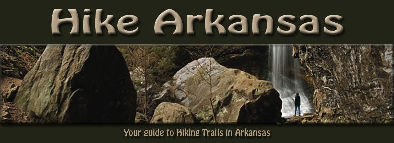
This site is courtesy of ArkansasUSA | ||

NATIONAL FOREST TRAILS
Ouachita Trail, Ouachita National Forest and Queen Wilhelmina & Pinnacle Mtn. State Parks
• Miles: 222.5 miles one way (first 50 miles are in Oklahoma)
• Rating: Easy to Difficult
• Allowed: Camping and Dogs
• Map and Trail description available: Ouachita Trail Guide by Tim Ernst
• Contact: Ouachita National Forest Phone 501-321-5202
This is the longest hiking trail in Arkansas. Actually, it begins in Oklahoma, at Talimena State Park, runs across the full length of the Ouachita National Forest, and ends up at Pinnacle Mountain State Park near Little Rock. The Ouachita Trail (OT) is a true long-distance backpacking trail. It also has a number of spur and loop trails that join it, plus lots of other access, so it’s great for dayhiking as well. Much of this trail runs along high ridgetops, with great views out across the countryside. But it sees its share of other special scenic spots (SSS) areas too, like wilderness areas, streams, springs and lush hillsides. There is a multitude of geological formations-rock gardens and glaciers, moss-covered boulders, and strange looking outcrops dot the landscape.
Womble Trail, Ouachita National Forest
• Miles: 39.5 one way
• Rating: Easy to Moderate
• Allowed: Camping and Dogs, heavy bicycle use on most of the trail
• Map and Trail descriptions available: Arkansas Hiking Trails guidebook by Tim Ernst
• Contact: Oden Ranger District Phone 870-326-4322
This is the third longest trail in Arkansas. The views are breathtaking, and there are lots and lots of large trees along the way. There are a number of hefty climbs, but for the most part the trail is a pleasure to hike. Most of the trail is in the Ouachita National Forest, so camping is allowed along the route, and there are three short spur trails down to campgrounds on the Ouachita River. Watch out for heavy mountain bike traffic - this has become one of the main bike trails in this part of the United States.
Eagle Rock Loop, Ouachita National Forest
• Miles: 26.8
• Rating: Easy to Difficult
• Allowed: Camping and Dogs, Horses are allowed on the Viles Branch section.
• Map and Trail description available: Arkansas Hiking Trails guidebook by Tim Ernst
• Contact: Caddo Ranger District Phone 870-356-4186
This is the longest loop hike in Arkansas. It is actually a combination of three trails (the Little Missouri, the Athens-Big Fork, and part of the Viles Branch Horse Trail). It loops through a large chunk of the Ouachita National Forest southwest of Hot Springs. This makes a perfect weekend trail, or even a nice three-day hike.
Little Blakely Loops, Ouachita National Forest
• Miles: 18.6 miles total
• Rating: Easy to Moderate
• Allowed: Camping, dogs and bicycles
• Map and Trail description available: Arkansas Hiking Trails guidebook by Tim Ernst
• Contact: Jessieville Ranger District Phone 501-984-5313
There are actually five loops that all connect here, allowing a variety of lengths of hikes. Each loop has its own unique features, from glades, to boulder fields, to giant trees. The entire area is located in the Ouachita National Forest, so camping is allowed.
South and Big Tree Loops-10.2 miles total
Rocky Ridge Loop-2.5 miles total
Glades Loop-1.8 miles total
Morgan Hollow Loop-4.1 total
Little Missouri Trail, Ouachita National Forest
• Miles: 15.7 miles one way
• Rating: Easy to Moderate
• Allowed: Camping and dogs
• Map and Trail description available: Arkansas Hiking Trails guidebook by Tim Ernst
• Contact: Caddo Ranger District Phone 870-356-4186
This is one of the most scenic and easy backpacking trails in Arkansas. It follows the Little Missouri River, which is a National Wild and Scenic River, passes Little Missouri Falls, follows along a historic wagon trail, and goes through the Winding Stairs area, which has perhaps the best swimming hole anywhere! This is an especially good trail to hike during the summer, since the river always has water in it.
Black Fork Mountain Wilderness Trail, Ouachita National Forest
• Miles: 11.6 round trip
• Rating: Moderate to Difficult
• Allowed: Camping and Dogs
• Map and Trail description available: Arkansas Hiking Trails guidebook by Tim Ernst
• Contact: Mena Ranger District Phone 479-394-2382
This mountain-top wilderness trail has some incredible views up and down the upper Ouachita River and Big Creek valleys, and the Rich Mountain/Talimena Scenic Drive area across the way. The route of this trail (much of it on old roads) gets pretty steep at times-this is a tough trail-but the rewards are certainly worth it. There is very little water along the route, so be sure to carry plenty. Also, there is a healthy black bear population in the area, so be a good clean camper, don’t leave food in your tent, and be alert! If you are a real strong hiker, you could dayhike this trail. I would recommend that you backpack it, though, and spend the night somewhere near the end of the trail-just take it easy as you go up, and enjoy the views.
Caney Creek Trail, Caney Creek Wilderness, Ouachita National Forest
• Miles: 9.6 miles one way
• Rating: Moderate
• Allowed: Camping, Dogs, and Horses
• Map and Trail description available: Arkansas Hiking Trails guidebook by Tim Ernst
• Contact: Mena Ranger District Phone 479-394-2382
This is one of the best trails in Arkansas. Most of it runs along picturesque Caney Creek, and crosses the Caney Creek Wilderness Area from end to end. The only drawback to this trail is that it fords the creek many times, and crosses the Cossatot River on the west end (much larger than Caney Creek)-it’s a great trail to hike in the summer, when you don’t mind getting your feet wet!
Athens-Big Fork Tail, Ouachita National Forest
• Miles: 9.1 one way
• Rating: Moderate to Difficult
• Allowed: Camping and Dogs
• Map and Trail description available: Arkansas Hiking Trails guidebook by Tim Ernst
• Contact: Caddo Ranger District Phone 870-356-4186
This is one of the most unique trails in the state. It was built over a hundred years ago as a mail route between the communities of Athens and Big Fork. It is a steep, tough trail, but if you can make it, the trip is worth it for the views alone-especially during leaf-off, when it’s hard to keep your eyes on the trail!
Hole in the Ground Mountain Trail, Ouachita National Forest
• Miles: 7.3 round trip
• Rating: Moderate
• Allowed: Camping and Dogs
• Map and Trail description available: Arkansas Hiking Trails guidebook by Tim Ernst
• Contact: Cold Springs Ranger District Phone 479-675-3233
This trail is a bit of a sleeper-not too many folks know about or hike it. The first section of the trail looks down into a remarkable horseshoe bend in Jack Creek, and later on there are some terrific views out across the mountains. The first section of this trail gets pretty steep, but does level off on top of the ridge after a while. This is a good trail to use to access the Dry Creek Wilderness nearby if you’re looking for a longer hike into the area.
Brushy Creek Loop, Ouachita National Forest
• Miles: 6.9
• Rating: Moderate
• Allowed: Camping and Dogs
• Map and Trail descriptions available: Arkansas Hiking Trails guidebook by Tim Ernst
• Contact: Oden Ranger District Phone 870-326-4322
There are several trails in the area of Big Brushy Campground in the Ouachita National Forest, which is located on Hwy. 270 between Y-City and Mt. Ida. One of them, the Brushy Trail, connects with a portion of the Ouachita Trail and makes a nice loop. The trail begins at the very back of the campground there, and is blazed with white paint. And with the exception of one long, steep grade, it’s a real easy trail to hike.
Tall Peak Trail, Ouachita National Forest
• Miles: 6.4 round trip
• Rating: Moderate
• Allowed: Camping and dogs
• Map and trail description available: Arkansas Hiking Trails guidebook by Tim Ernst
• Contact: Mena Ranger District Phone 479-394-2382
This trail does just exactly what you think it does-it climbs up to the tallest peak in the area, which is 2330 feet tall, and is called Tall Peak. But it also runs along a wonderful little stream, crossing it four times.
Winding Stairs Trail, Albert Pike Recreation Area, Ouachita National Forest
• Miles: 5.25 miles one way
• Rating: Moderate
• Allowed: Camping and dogs
• Map and Trail description available: Caddo Ranger District, 912 Smokey Bear Lane, Glenwood, AR 71943
• Contact: www.fs.fed.us/oonf/ouachita or Phone 870-356-4186
This trail follows the Little Missouri River and allows access to an area known for its scenic beauty, popular swimming holes and challenging fishing opportunities. There are cascading waterfalls, abundant wildflowers and impressive spring and fall colors which contribute to the popularity of this trail. The trail provides several spectacular overlooks of the river. The most scenic spot on the trail is where Raven Branch flows into the river. There are large novaculite outcroppings overlooking the river which make this a popular spot for photographers. This trail is popular with both day and overnight hikers. This trail, combined with the Little Missouri Trail, provides about 16 miles of trail along the Little Missouri River.
Buckeye Mountain Trail, Ouachita National Forest
• Miles: 4.6
• Rating: Moderate
• Allowed:
• Map and Trail description available: Arkansas Hiking Trails guidebook by Tim Ernst
• Contact: www.fs.fed.us/oonf/ouachita or Phone 479-394-2382, Mena Ranger District, 1603 Hwy. 71 North, Mena, AR 71953
The Buckeye Mountain Trail is a short spur trail which connects with the Caney Creek Trail at its midpoint. It is primarily a ridgetop trail through the Caney Creek Wilderness area which offers magnificent views into the Caney Creek watershed. The Buckeye Trail, combined with the Caney Creek Trail, can provide a good day-long loop hike or a versatile overnight hike.
Hunts Loop, Ouachita National Forest
• Miles: 4.3
• Rating: Moderate
• Allowed: Camping and Dogs
• Map and Trail description available: Arkansas Hiking Trails guidebook by Tim Ernst, Mena Ranger District, 1603 Hwy. 71 North, Mena, AR 71953
• Contact: Jessieville Ranger District Phone 501-984-5313
This nice loop trail begins at the Iron Springs Recreation Area, climbs up Short Mountain, then connects with the Ouachita Trail and loops back around to the beginning. It’s got some great views, visits stand of big trees, and passes by some neat streamside areas.
Charlton Trail, Ouachita National Forest
• Miles: 4.2 miles one way
• Rating: Easy to Moderate
• Allowed: Camping, Dogs and Bicycles
• Map and Trail description available: Arkansas Hiking Trails guidebook by Tim Ernst, Mena Ranger District, 1603 Hwy. 71 North, Mena, AR 71953
• Contact: Womble Ranger District Phone 870-867-2101
There are a couple of pretty good climbs, nice views, and a spring half way. It begins at Charlton Recreation Area on Hwy. 270 between Hot Springs and Mt. Ida. There is a swimming lake there, campground and picnic area, but it is closed during the winter, which will add some to your hike.
Lake Sylvia Loop, Ouachita National Forest
• Miles: 4.1
• Rating: Easy
• Allowed: Dogs, camping in campground
• Map and Trail description available: Arkansas Hiking Trails guidebook by Tim Ernst, Mena Ranger District, 1603 Hwy. 71 North, Mena, AR 71953
• Contact: Winona Ranger District Phone 501-889-5176
This trail, west of Little Rock, connects with a part of the Ouachita Trail and an interpretive trail, overlooks a spectacular rock canyon area, and loop back along the shores of Lake Sylvia to the trailhead. It is located in the Ouachita National Forest. It’s great for dayhiking.
Sugar Creek Trail, Ouachita National Forest
• Miles: 3.5
• Rating: Difficult
• Allowed:
• Map and Trail description available: none
• Contact: Cold Springs Ranger District Phone 479-675-3233
The trail connecting Knoppers Ford Recreation Area to Jack Creek Recreation Area covers challenging terrain offering excellent views of the Sugar, Middly and Jack Creek drainages and surrounding countryside. A short day hike on the trail allows visitors to view abundant wildlife, interesting geological formations and pine/hardwood forests.
Shady Lake Trail, Mena Ranger District, Ouachita National Forest
• Miles: 3.1
• Rating: Easy
• Allowed:
• Map and Trail description available: None
• Contact: Mena Ranger District Phone 479-394-2382
The CCC developed the Shady Lake Recreation Area in 1937. The Shady Lake trail traverses Saline Creek and passes the historic Shady Lake Dam. It continues along the opposite side of the lake up West Saline Creek. The trail is ideal for day hiking. Mountain bikers may also use the trail.
Wildlife Trail, Lake Sylvia Recreation Area, Ouachita National Forest
• Miles: 2.33 miles
• Rating: Moderate to Difficult
• Allowed:
• Map and Trail description available: Winona Ranger District, 1069 N. Fourche, Perryville, AR 72126
• Contact: www.fs.fed.us/oonf/ouachita or Phone 501-889-5176
This trail consists of two loops and a spur trail. Loop A is a one-mile wildlife interpretive trail that returns by the Lake Sylvia dam and affords a beautiful vies of Narrow Creek and its bluffs. Loop B starts on the back side of Loop A and affords a nice vista of the east fork of Narrow Creek and Lake Sylvia. This loop returns to Loop A, and their length totals 1 1/2. The 3/4-mile spur up Chinquapin Mountain begins on the back side Loop B. The top of the mountain presents a 270-degree panoramic view, including Lake Maumelle and Flatside Pinnacle. This trail complex has short grades in excess of 10 percent, but its views are more than worth the effort.
Earthquake Ridge Trail, Ouachita National Forest
• Miles: 2.1
• Rating: Easy to Moderate
• Allowed: Camping, Bicycles and Dogs
• Map and Trail description available: Arkansas Hiking Trails guidebook by Tim Ernst or Arkansas Dayhikes for Kids and Families by Pam Ernst
• Contact: Mena Ranger District Phone 479-394-2382
This short loop trail is one of two that is located at the Mena Visitor Center of the Forest Service, which is just west of Mena on hwy 88 up on the Talimena Scenic Byway. It is used by mountain bikes once in a while.
Serendipity Loop, Ouachita National Forest
• Miles: 1.0
• Rating: Easy
• Allowed: Dogs
• Map and Trail description available: Arkansas Hiking Trails guidebook by Tim Ernst or Arkansas Dayhikes for Kids and Families by Pam Ernst
• Contact: Oden Ranger District Phone 870-326-4322
This is a very short, easy to hike, and the signs there interpret the forest like no other trail. It’s in the Ouachita National Forest, right across from the Oden District Ranger’s Office. Definitely worth a side trip to go see.
Tree Of The Forest Trail, Lake Sylvia Recreation Area, Ouachita National Forest
• Miles: 1.0 mile round trip
• Rating: Easy **Wheelchair accessible**
• Allowed:
• Map and Trail description available: Arkansas Dayhikes for Kids and Families by Pam Ernst or Winona Ranger District, 1069 N. Fourche, Perryville, AR 72126
• Contact: www.fs.fed.us/oonf/ouachita or Phone 501-889-5176
This tree identification interpretive trail begins at the parking lot just past the Lake Sylvia camping entrance. The first half of the trail has an asphalt surface, and is an easy walk across the hardwood floodplain of Narrow Creek’s east forks. This part of the trail is easily negotiable by wheelchairs. The second half has a gravel surface with grades up to 5 percent. This section is equipped with a wooden cane rail along the base of the trail for the visually impaired.
Friendship Interpretive Loop, Ouachita National Forest
• Miles: nine-tenths of a mile (.9)
• Rating: Easy
• Allowed: Dogs
• Map and Trail description available: Arkansas Hiking Trails guidebook by Tim Ernst or Arkansas Dayhikes for Kids and Families by Pam Ernst
• Contact: Jessieville Ranger District Phone 501-984-5313
This is a beautiful little trail that is paved and is barrier free. It loops around through the woods behind the Forest Service Visitor Center at Jessieville. Take your lunch with you and stop at one of the many benches or picnic tables and enjoy some time outside.
Prayer of the Woods Trail, Charlton Recreation Area, Ouachita National Forest
• Miles: three-fourths of a mile (.75)
• Rating: Easy
• Allowed:
• Map and Trail description available: Womble Ranger District, 1523 U.S. 270 East, Mt. Ida, AR 71957
• Contact: www.fs.fed.us/oonf/ouachita or Phone 870-867-2101
An easy one-hour hike along this interpretive trail allows visitors to see many of the 55 species of plants native to the area. Interpretive signs are located at key interest points. This loop trail was developed by the Forest Service as a cooperative project with the Arkansas Federation of Garden Clubs, Inc. and the Weyerhaeuser Foundation.
Crystal Recreation Area Loop, Ouachita National Forest
• Miles: seven-tenths of a mile (.7)
• Rating: Easy
• Allowed: Dogs
• Map and Trail description available: Arkansas Hiking Trails guidebook by Tim Ernst
• Contact: Caddo Ranger District Phone 870-356-4186
This is another short, seldom used, easy trail that loops around through some huge eighty-year-old trees.
Orchard Trail, Mena Ranger District, Ouachita National Forest
• Miles: one-half of a mile (.5)
• Rating: Easy **Wheelchair Accessible**
• Allowed:
• Map and Trail description available: or Arkansas Dayhikes for Kids and Families by Pam Ernst
• Contact: Mena Ranger District Phone 479-394-2382
This accessible trail meanders through the picturesque pine and hardwood forest surrounding the Talimena Scenic Byway Visitor Information Station near Mena. This short hike features the ruins of an abandoned home site with a viewing deck and benches. This trail and all site facilities allow easy access for all visitors including those physically challenged.
A Valuable Forest Trail, Shady Lake Recreation Area, Ouachita National Forest
• Miles: one-half of a mile (.5)
• Rating: Easy
• Allowed:
• Map and Trail description available: Caddo Ranger District, 912 Smokey Bear Lane, Glenwood, AR 71943 or Arkansas Dayhikes for Kids and Families by Pam Ernst
• Contact: www.fs.fed.us/oonf/ouachita or Phone 870-356-4186
This is an interpretive trail. Etched metal signs along the trail tell how the forest was formed and describe the relationships between weather, rocks, soil and the plants growing in the area. The trail is an easy walk along the east fork of the Saline River. Many hikers cool their feet in the stream’s numerous pools.
Crystal Mountain Scenic Area Loop, Ouachita National Forest
• Miles: one half of a mile (.5)
• Rating: Easy
• Allowed: Dogs
• Map and Trail description available: Arkansas Hiking Trails guidebook by Tim Ernst
• Contact: Caddo Ranger District Phone 870-356-4186
This is short, little used, easy trail that goes by old, old trees in the Ouachita National Forest.
NATIONAL PARKS TRAILS
Sunset Loop, Hot Springs National park
• Miles: 8.0
• Rating: Moderate
• Allowed: No Dogs
• Map and Trail description available: Arkansas Hiking Trails guidebook by Tim Ernst
• Contact: Hot Springs National Park Phone 501-624-3383
This ridgetop trail in Hot Springs National Park overlooks the city of Hot Springs. There are lots of great views as the trail goes along the crest of West, Music and Sugarloaf mountains, big trees, and even some geological formations. There are actually a lot trails that wind around the hills of Hot Springs. This is one of the best! And when you get done, you can go get a massage and soak your tired feet!
The Grande Promenade, Hot Springs National Park
• Miles: one-third of a mile (.33)
• Rating: Easy **Wheelchair accessible**
• Allowed: Dogs
• Map and Trail description available: National Park Visitor Center
• Contact: www.nps.gov/hosp or Phone 501-624-3383
The Grande Promenade is a brick-paved trail that divides the city development from Hot Springs mountain. Along the trail are many benches, native and ornamental plants, an abundance of birds, and hot springs. Several scenic overlooks allow views of the city and the Ouachita Mountains. This is a really nice and wide sidewalk that takes you up and away from the busy Bathhouse Row.
U.S. ARMY CORPS OF ENGINEERS TRAILS
Forest Hills Trail, Nimrod Lake Corps Office, Corps of Engineers
• Miles: 1.5
• Rating: Easy to Moderate
• Allowed:
• Map and Trail description available: or Arkansas Dayhikes for Kids and Families by Pam Ernst
• Contact:
The trailhead starts on the south side of Nimrod Dam and meanders through the wooded hills and valleys. Along the trail there are 18 points of interest, which are explained in the trail guide. These points of interest range from trees to vegetation to history of the area. Along the trail, you will cross a foot bridge, be able to view the dam from the hill above and see the Highway 7 Fourche River bridge from a scenic bluff above the river.
Arlie Moore Interpretive Trail, DeGray Lake Area, Corps of Engineers
• Miles: 1.33 mile
• Rating: Easy
• Allowed:
• Map and Trail description available: Corp of Engineers Visitor Center
• Contact: Phone 870-246-5501
This trail has an interconnecting loop which allows you to cut the hike in half. The focus of the trail is the natural environment. Numbered posts correspond to a trail booklet and describe tree species, timber management and animals.
ARKANSAS STATE PARKS TRAILS
Lake Catherine Loop, Lake Catherine State Park
• Miles: 9.5 total for three trails
• Rating: Easy to Moderate
• Allowed: Dogs
• Map and Trail description available: Arkansas Hiking Trails guidebook by Tim Ernst
• Contact: Lake Catherine State Park Phone 501-844-4176
There are three trails at this State Park. All of them are quite scenic, and spend some time running along or looking down on lake Catherine. There are lots of rock formations, lush vegetation, big trees, and a great waterfall. A parking/entrance fee may be required.
Wildlife Lane, Millwood State Park
• Miles: 4.0
• Rating: Easy
• Allowed: Dogs, Bicycles
• Map and Trail description available: Arkansas Hiking Trails guidebook by Tim Ernst
• Contact: millwood@arkansas.com or Phone 870-898-2800
The path takes advantage of an area that floods periodically thus the trail is closed at times. This is a multi-user trail with hikers having the right of way.
Caddo Bend Loop, Lake Ouachita State Park
• Miles: 3.9
• Rating: Easy
• Allowed: Dogs
• Map and Trail description available: Arkansas Hiking Trails guidebook by Tim Ernst
• Contact: Lake Ouachita State Park Phone 501-767-9366
This trail is located at Lake Ouachita State Park near Hot Springs. It’s an easy trail that loops around a peninsula that sticks out into Lake Ouachita, the largest lake in Arkansas. Since it follows closely to the shoreline, this is a great trail to hike in the summer-just hop in when you get hot! This park has several campgrounds and cabins available. They also have some unique summer programs-check in at the Visitor Center. A parking/entrance fee to hike may be required-ask at the Visitor Center.
Coastal Plains Trail, White Oak Lake State Park
• Miles: 3.0
• Rating: Easy
• Allowed: Dogs
• Map and Trails description available: Arkansas Hiking Trails guidebook by Tim Ernst or Arkansas Dayhikes for Kids and Families by Pam Ernst
• Contact: White Oak Lake State Park Phone 870-685-2748
This trail is a 3 mile spur/loop from the southeast corner of the Beech Ridge Trail, which meanders through some of southern Arkansas’s most unique terrain. Look for Arkansas Oak, Loblolly Pine, and other unusual members of the sandhills community along this scenic trail. As you walk near the lake watch for great blue herons, green herons and great egrets.
White Oak Lake Loop Trail, White Oak Lake State Park
• Miles: 2.0
• Rating: Easy
• Allowed: Dogs
• Map and Trails description available: Arkansas Hiking Trails guidebook by Tim Ernst or Arkansas Dayhikes for Kids and Families by Pam Ernst
• Contact: White Oak Lake State Park Phone 870-685-2748
This trail is certainly in an out of the way place (White Oak Lake State Park-east of Hope), but I think it’s worth the effort to get there. I can’t quite put my finger on it, but there is a certain wonderful feeling that you get as you walk the first section of this trail. Maybe it’s the huge, towering trees all around you. I don’t know. But it’s nice. This is a pretty easy trail to hike. The loops is actually tow trails joined together-the Beech Ridge and Coastal Plains trails. The short Spring Branch Nature Trail at the park is also worth a look.
Daisy Creek Trail, Daisy State Park
• Miles: 2.0
• Rating: Easy to Moderate
• Allowed: Dogs
• Map and Trail description available: Arkansas Dayhikes for Kids and Families by Pam Ernst
• Contact: daisy@arkansas.com or Phone 870-398-4487
Wooded areas and lakeshore views. Trail wanders through a variety of terrain of mixed pine and hardwood. For a short distance along the lake. Goes through two areas on lowland type terrain and over hilly areas. Connect with and some times overlapping with 32 miles of Multi-Use trail in area.
Waterfowl Way Trail, Millwood State Park
• Miles: 1.5
• Rating: Easy
• Allowed: Dogs
• Map and Trail description available: Arkansas Hiking Trails guidebook by Tim Ernst or Arkansas Dayhikes for Kids and Families by Pam Ernst
• Contact: Millwood State Park Phone 870-898-2800
This unique trail at Millwood State Park is the only one in Arkansas where you have a chance to see an alligator! Plus there is lots of other wildlife to see, like a beaver lodge, and of course a bunch of waterfowl, including blue herons, white egrets, bald eagles, geese, and tons of ducks. The park is located on Hwy. 32 between Ashdown and Sartoga in extreme southwest Arkansas. There is a nice campground there, and a marina. An entrance fee may apply.
River Trail, Crater of Diamonds State Park
• Miles: 1.3 miles
• Rating: Easy
• Allowed: dogs
• Map and Trail description available: Arkansas Dayhikes for Kids and Families by Pam Ernst
• Contact: craterofdiamonds@arkansas.com or Phone 870-285-3113
The trail begins at the campground, meanders through the pine/hardwood forest to the Little Missouri River. The trail then loops back through the forest to the trailhead.
Prospector Trail, Crater of Diamonds State Park
• Miles: 1.2
• Rating: Easy
• Allowed: Dogs
• Map and Trail description available: Visitor Center
• Contact: craterofdiamonds@arkansas.com or Phone 870-285-3113
The trail begins at the campground, meanders through the pine/hardwood forest to the Little Missouri River. The trail then loops back through the forest to the trailhead.
Lovers’ Leap Loop, Queen Wilhelmina State Park
• Miles: 1.1
• Rating: Easy
• Allowed: Dogs
• Map and Trail description available: Arkansas Hiking Trails guidebook by Tim Ernst
• Contact: Queen Wilhelmina State Park Phone 501-394-2863
This short loop is located high atop Rich Mountain in Queen Wilhelmina State Park (lodge and other facilities there), on the Talimena Scenic Drive, about 14 miles from Mena. The trailhead is located behind the lodge, around to the left.
Island Trail, DeGray Lake Resort State Park
• Miles: 1.0
• Rating: Easy
• Allowed: Dogs
• Map and Trail description available: Visitor Center or Lodge or Arkansas Dayhikes for Kids and Families by Pam Ernst
• Contact: degraylakeresort@arkansas.com or Phone 501-865-2801
The trail begins near the front entrance of the lodge. The first 75-100 yards lead to a road crossing, the trail splits into a loop which circles back to the beginning. Hardwoods predominate the forest canopy. The trail is located 50-60 feet from the lakeshore and provides the opportunity for solitude and scenic beauty.
Green Heron Trail, DeGray Lake Resort State Park
• Miles: three-quarters of a mile (.75)
• Rating: Easy
• Allowed: Dogs
• Map and Trail description available: Visitor Center or Lodge
• Contact: degraylakeresort@arkansas.com or Phone 501-865-2801
For the bird watcher, this trail offers some of the best viewing opportunities in the park. The wildlife viewing station along the trail offers an excellent vantage point for spotting eagles and waterfowl. The trail begins at the Visitor Center.
Brushy Creek Trail, Cossatot State Park
• Miles: three-quarters of a mile (.75)
• Rating: Moderate **Wheelchair Accessible**
• Allowed: Dogs
• Map and Trail description available: None
• Contact: cossatotriver@arkansas.com or Phone 870-385-2201
The trail provides a walk along a very interesting part of the Cossatot River. The trail starts on the west side river access adjacent to State Highway 246. It goes across the river on a large pedestrian bridge. Once across the bridge follow the boardwalk around and across the east side access road. Here you will climb a series of steps and enter a forested ridge. The trail takes you along this wooded ridge where the river makes a big looping horseshoe. This trail loops around and brings you to the Brushy Creek Picnic Area, very popular day use area.
Crane Fly Trail, Logoly State Park
• Miles: three-quarters of a mile (.75)
• Rating: Moderate
• Allowed: Dogs
• Map and Trail description available: Visitor Center or Arkansas Dayhikes for Kids and Families by Pam Ernst
• Contact: logoly@arkansas.com or Phone 870-695-3561
The trail leads you by a small pond and several woodland streams. A boardwalk crosses over the pond at one location, and the trail offers excellent opportunities
for plant and wildlife observation.
Chickadee Trail, DeGray Lake Resort State Park
• Miles: one-half of a mile (.5)
• Rating: Easy
• Allowed: Dogs
• Map and Trail description available: Visitor Center
• Contact: degraylakeresort@arkansas.com or Phone 501-865-2801
This trail begins behind the Park Store near the tennis courts. This loop trail takes you through a pine forest down along the shoreline. It is a wonderful trail for anyone interested in seeing waterfowl and wading birds, as well as those favoring pine forests.
Towering Pines Trail, DeGray Lake Resort State Park
• Miles: one-half of a mile (.5)
• Rating: Easy to Moderate
• Allowed: Dogs
• Map and Trail description available: Visitor Center or Lodge or Arkansas Dayhikes for Kids and Families by Pam Ernst
• Contact: degraylakeresort@arkansas.com or Phone 501-865-2801
This loop trail meanders through the mixed pine and hardwood forest to the lakeshore and returns to its point of origin. It is particularly spectacular in the spring as it displays an abundance of dogwood trees.
Dogwood Trail, Lake Ouachita State Park
• Miles: one-half mile (.5)
• Rating: Easy
• Allowed: Dogs
• Map and Trail description available: Visitor Center or Arkansas Dayhikes for Kids and Families by Pam Ernst
• Contact: lakeouachita@arkansas.com or Phone 501-767-9366
This is a loop trail which leads hikers in to the National Forest surrounding the Lake. There are 12 interpretive signs explaining the forest equality.
Spring Trail, Queen Wilhelmina State Park
• Miles: one-half mile (.5)
• Rating: Easy
• Allowed: Dogs
• Map and Trail description available: Visitor Center or Arkansas Dayhikes for Kids and Families by Pam Ernst
• Contact: Queen Wilhelmina State Park Phone 501-394-2863
Beginning behind the stage at the amphitheater you’ll walk west 100 yards to the spring. This was a favorite gathering place for early mountain settlers and is still a great oasis of relaxation and reflection. The trail continues past the spring for about 1/2 mile and comes out on State Highway 88 across from the west end of the campground.
Reservoir Trail, Queen Wilhelmina State Park
Miles: one-third of a mile (.330)
• Rating: Moderate
• Allowed: Dogs
• Map and Trail description available: Visitor Center or Arkansas Dayhikes for Kids and Families by Pam Ernst
• Contact: Queen Wilhelmina State Park Phone 501-394-2863
This trail begins at the lodge at the stairs and continues 1/3 of a mile down the hill to a stone reservoir. The reservoir was part of the water system for the 1898 hotel. Just up the hill from the reservoir is an excellent spring that was said to have curative powers.
Spring Branch Trail, White Oak Lake State Park
• Miles: one-third of a mile (.33)
• Rating: Easy
• Allowed: Dogs
• Map and Trails description available: Visitor Center or Arkansas Dayhikes for Kids and Families by Pam Ernst
• Contact: White Oak Lake State Park Phone 870-685-2748
Beginning at the trailhead located in the picnic area, this gentle loop trail features the White Oak trees our park is named for, many species of lovely ferns, several species of pine, American Holly Trees, Gray Squirrels, Whitetail Deer, and the quiet and solitude of Spring Branch.
Cossatot Falls Trail, Cossatot State Park
• Miles: one-third of a mile (.33)
• Rating: Difficult ****Hazardous when wet****
• Allowed: Dogs
• Map and Trail description available: None
• Contact: cossatotriver@arkansas.com or Phone 870-385-2201
This trail begins at the parking area at the Cossatot Falls Access area. At the head of this trail will be 4 wayside exhibit panels which assist visitors with the information about the falls area. The trail takes you along the river and the six rocky drops that form Cossatot Falls. The trail crosses over gravel bars and huge layers of uplifted sandstone. This is a difficult trail so watch your step and use caution. This weathered sandstone is particularly difficult to walk on when wet. The trail ends at the last rapid along a sandstone shelf of solid rock.
Saginaw Historic Trail, DeGray Lake Resort State Park
• Miles: one-quarter of a mile (.25)
• Rating: Easy
• Allowed: Dogs
• Map and Trail description available: Visitor Center or Lodge
• Contact: degraylakeresort@arkansas.com or Phone 501-865-2801
This trail follows an old narrow-gauge railroad bed used by lumbermen around 1900. The trail begins near the dumpstation and is a shortcut to the lake.
Deer Run Trail, Moro Bay State Park
• Miles: one-quarter mile (.25)
• Rating: Easy
• Allowed: Dogs
• Map and Trail description available: Arkansas Dayhikes for Kids and Families by Pam Ernst
• Contact: morobay@arkansas.com or Phone 870-463-8555
Deer Run Trail is best known for the beautiful and unusual Mayhaw trees, an edible variety of hawthorn. These trees are found within the park’s bottomlands. The fruit of this tree makes a fine jelly. Deer and other wildlife are regularly seen along the trail.
Low Water Trail, Moro Bay State Park
• Miles: one-quarter mile (.25)
• Rating: Easy
• Allowed: Dogs
• Map and Trail description available: None
• Contact: morobay@arkansas.com or Phone 870-463-8555
Meandering through some of the largest trees in this area of the state, the trail offers hikers an opportunity to view plenty of wildlife and bird activity. The trail is open when the Ouachita River is not flooding. (Usually late spring to late fall).
Magnesia Springs Trail, Logoly State Park
• Miles: one-quarter of a mile (.25)
• Rating: Easy
• Allowed: Dogs
• Map and Trail description available: Visitor Center
• Contact: logoly@arkansas.com or Phone 870-695-3561
This trail leads you through two food plots, by the Spring Branch Creek and over the rolling hills of the West Gulf Coastal Plain.
OTHER AGENCY'S TRAILS
Burns Park Scout Loop, City of North Little Rock
• Miles: 8.3
• Rating: Easy
• Allowed: Dogs
• Map and Trail description available: Arkansas Hiking Trails guidebook by Tim Ernst
• Contact: North Little Rock Parks and Recreation Phone 501-753-9312
This trail winds around through Burns Park, which is the large city park on the edge of North Little Rock. This is really a dayhiking trail, although there is a campground at the park, inside the loop. This trail is mainly used by the Boy Scouts. It’s a pretty easy trail to hike, with a few climbs here and there. It has lots of blooming things along the way!
White Cliffs Nature Trail, Arkansas Natural Heritage Commission
• Miles: 1.5
• Rating: Easy
• Allowed: Dogs
• Map and Trail description available: Arkansas Hiking Trails guidebook by Tim Ernst
• Contact: Arkansas Natural Heritage Commission Phone 501-324-9150
It will take you a while to find this trail, which is located near Lake Millwood in extreme southwest Arkansas, but it’s a nice little trail, with some significant trees and cliffs.